
Notes for the readers/viewers
- The readers can skip this section and the Prelude, in case they are interested only in the itinerary.
- To share as much information as possible, I provide hyperlinks to the Point of Interest(POIs), important events, geographical features and so on. I recommend readers to spot, and follow those hyperlinks.
- To avoid cluttering the post with details of every POI, I do NOT write the detailed reviews of the same.
- Some information might be left out unintentionally or out of time constraints. Feel free to contact me in case you need any relevant details.
- I try to post as many distinct pictures/photos as possible, to give a fair idea of the entities, but the objective is not to provide a photo album. Google Maps or, in general, on the Internet, aplenty pictures are available for the viewers.
Prelude
In spite of being in Sweden for almost 7 years, I had not managed a successful trek within Sweden. I had made up my mind to do it this year, either with company or solo, whichever materializes! I have put on a lot since 2016, also my fitness is in shambles. After some pondering, I zeroed-in on Storådorren and Helagsfjället.
To my pleasant surprise, my friend Dhananjay(henceforth, referred as ‘DJ’) committed to the trip, as his primary plan was cancelled.
Planning & Inc.
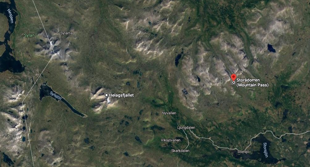
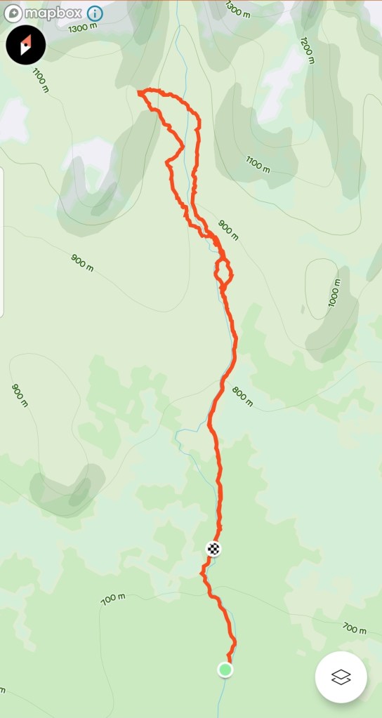
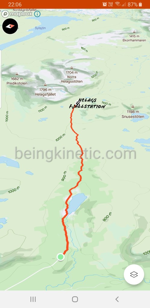
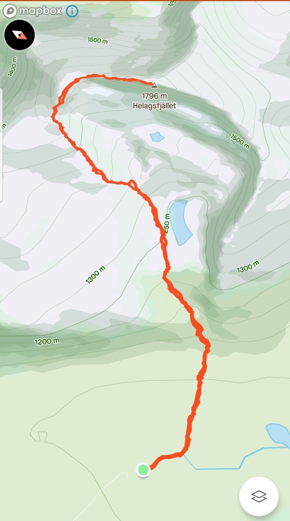
Refer the above image to gain clarity about the geography, and the plan.
– Situated close to the Norwegian border in the Jämtland region, a (one-way)drive of 600+km was required to reach the base area for these mountains.
– To reach Storådorren, staying at Ljungdalen seemed the best option.
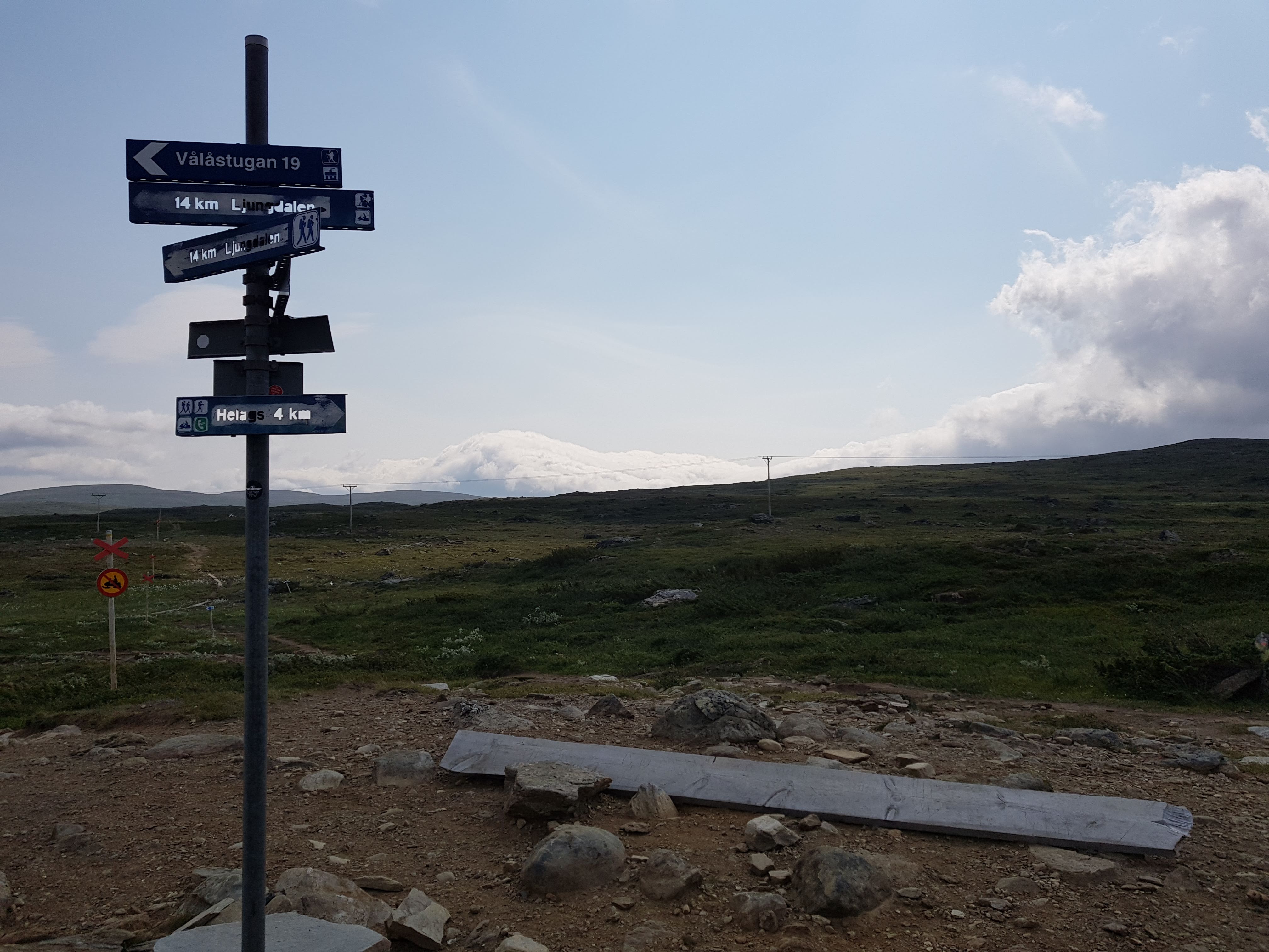
– (Thankfully)There is no motorable road to the base of Helags. From Ljungdalen, one has to drive till Kläppen, park the vehicle, walk 12km along a marked trail to the base of Helags. From the base to summit, it is around 4km, thus, to and fro, it is at least 8km. A stay, at least for a night, at STF Helags Fjällstation is crucial.
– One cannot trust the weather, hence, it was necessary to keep a buffer of at least one day for every POI.
It was already end of June. I didn’t want to overthink, and over-complicate the matter. Since there was not a single day’s booking available at STF Helags Fjällstation, I booked the entire stay (July 20 – July 25) at STF Ljungdalen. The plan was:
Day-1: Drive from Södertälje to Ljundalen.
Day-2: Storådorren.
Day-3: Rest. Relaxed sightseeing within a radius of 25km.
Day-4: Ljundalen – Helags – Ljungdalen. May require camping.
Day-5: Absolute rest.
Day-6: Drive back to Södertälje.
Plan for the Day-4 had made me apprehensive, since not only was it illogical but also beyond my physical capability. I was expected to walk 12km, then (steep!)climb 4km, descend 4km and walk back 12km, so, a 32km of activity.
I had asked DJ to check as frequently as possible for a booking at STF Helags Fjällstation during that week, even if it was for one night. By the Grace of the Almighty, while having breakfast on a weekend, I suddenly found an empty booking slot which I grabbed. July 22 – 23(night of July 22), we now had an assured stay. Now, another challenge surfaced – we had no chance to rest between the two treks:
Day-1: Drive from Södertälje to Ljundalen.
Day-2: Storådorren.
Day-3: Walk to STF Helags Fjällstation
Day-4: Helags summit. Later, walk back to Ljungdalen.
Day-5: Absolute rest.
Day-6: Drive back to Södertälje.
I am skipping the packing and other menial details associated with any trip :P.
My wife prepared energy bars full of dry fruits, also helped me packing small quantities of rice, cereals.
Day-1
July 20, 2021(Tuesday)
Objective(s): Reach STF Ljungdalen before 1700 hours, with some sightseeing en route.
We started to drive at 0510 hours. After some confusion caused due to misinterpreting Google Maps, we took a coffee break at OKQ8 Tierp around 0700 hours. My wife had packed sandwiches for breakfast and DJ had got bread and omelettes. We opened the boot, placed our cups and boxes, and gulped down the stuff. It was a bit cold. We started driving again around 0730 hours.
I prefer driving on country roads – the motorways bore me! So we made pact – I will drive on the country roads while DJ will take care of the motorways.
Apart from a 2-min. toilet break + changing driver, we drove non-stop till Kårböle, which was a 250km, mainly on E4, later, highway 83(Svenska: Riksväg 83). We stopped at Snörbo Rastplats(1030 hours), took some photos, munched on some snacks, answered Nature’s call, and started rolling again around 1100 hours. I left DJ in-charge of selecting a restaurant for lunch. Our lunch stop would be Sveg which was around 60km. En route, we stopped at Älvros church(Svenksa: Älvros gamla kyrka). It was by the ancient pilgrim route Härjulfle – Härjedalen – St. Olof’s grave in Nidaros(now, Trondheim).
We reached Sveg around 1145. Lunch tasted average. DJ was in pain due to a wound he suffered some days ago, so he rushed to Apotek to get medicine, meanwhile, I fetched milk, bread, and other basics. Since the maps didn’t show OKQ8, Ingo, etc. at Ljungdalen, we decided to fill-up. We started rolling again around 1300 hours. Soon, the weather turned even colder and cloudy, and I was already worrying about the next day.
The road(half of it, highway 84(Svenksa: Riksväg 84) from Sveg towards Ljungdalen has aplenty pleasant sights. Since it was a single-lane, 100km road with oncoming traffic, I kept my eyes on the road but couldn’t miss the mesmerizing water routes and mountains on my left(west and south). I later checked and found that those mountains can be reached via the Sonfjället National Park.
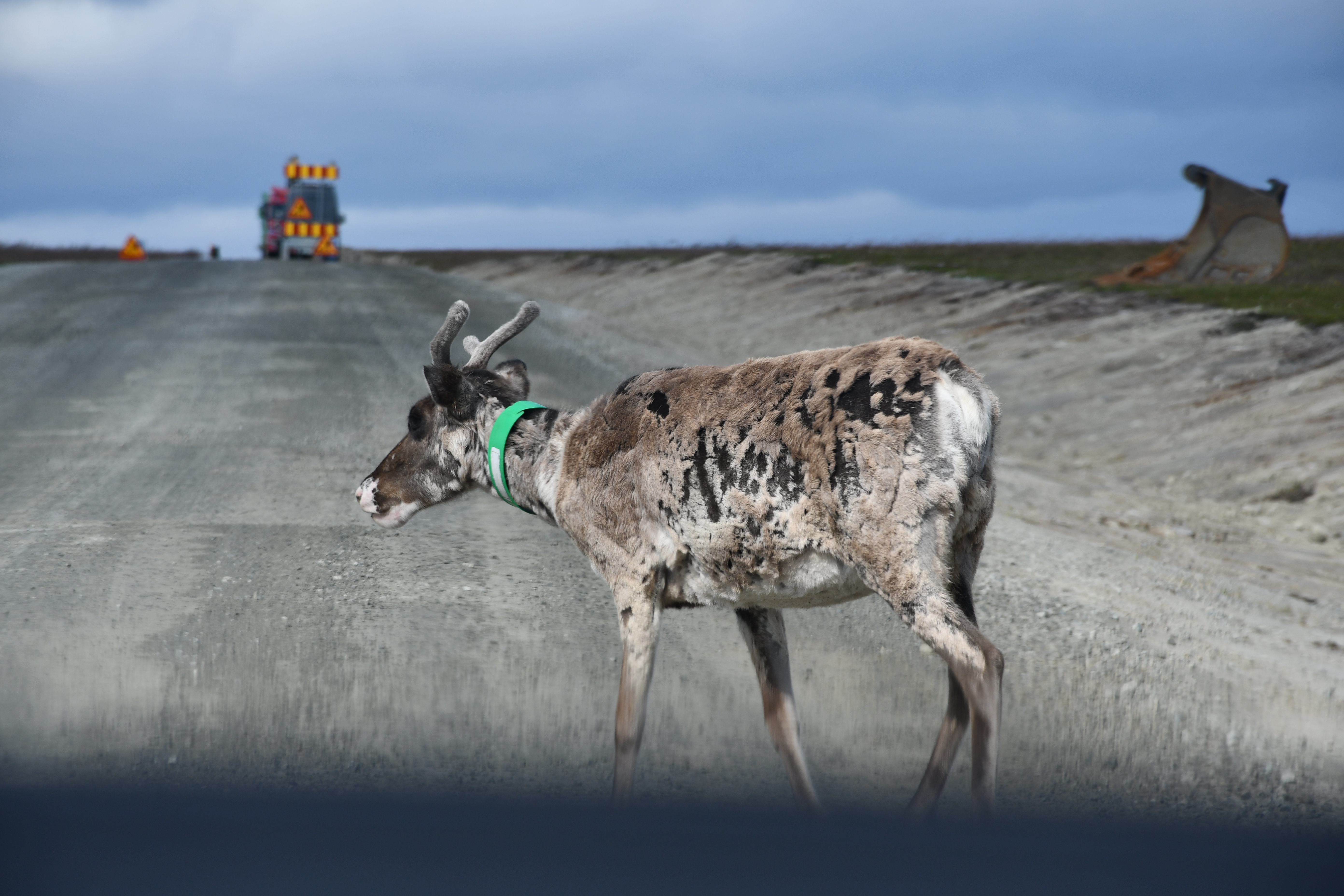
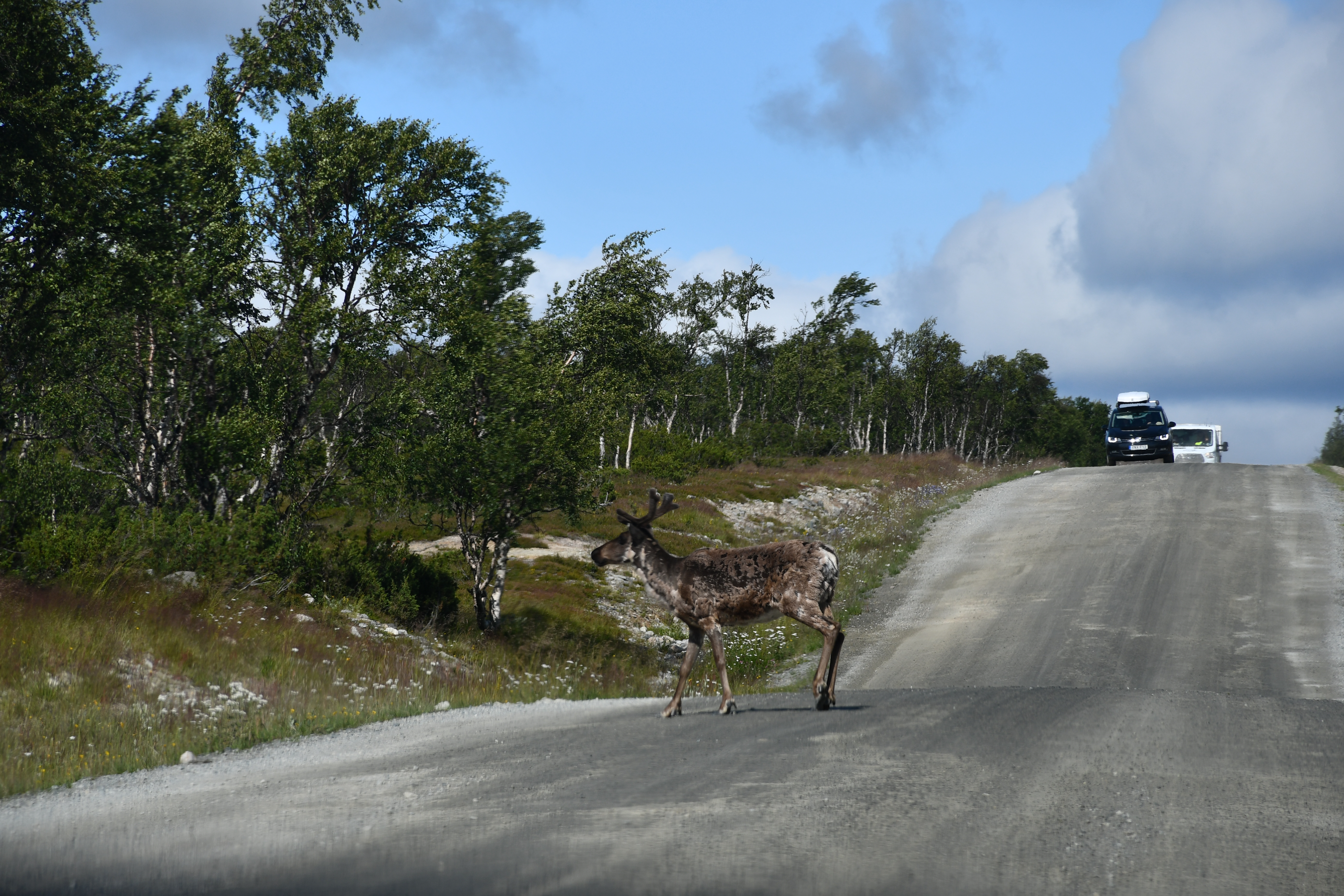
DJ reclined his seat and napped while I raced on the highway 84(Svenska: Riksväg 84). Just before Funäsdalen, DJ took the wheel, and I went doing what I like – compiling information 😀 . We soon took a narrow country road. Reindeers were crossing the roads in numbers equivalent to the pedestrians crossing the streets in Södertälje :P.

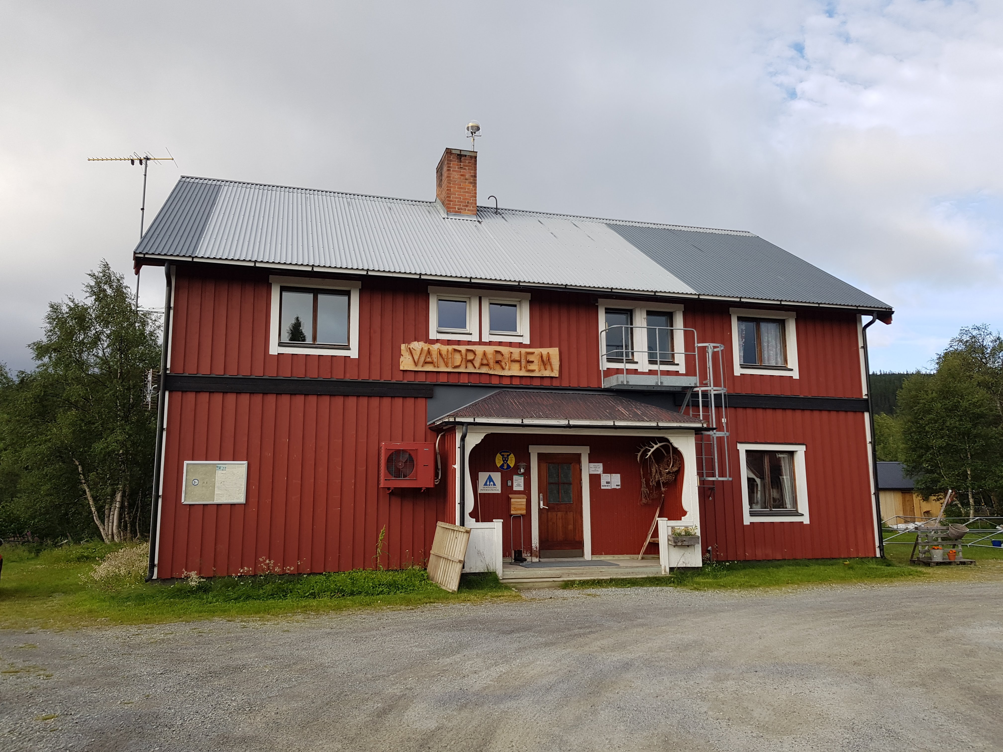
Some minutes before 1700 hours, we reached STF Ljungdalen. The caretaker, Eva, greeted us and handed the keys. The hostel has nice rooms, a sauna as well. Overall, it is value for money.
We met a 65+ year old lady who had checked-in only a while ago. She had reached here after a 10-day long hike from Slylarna. She gave us some good tips and was zealously describing her solo hiking experience which included several hiccups. DJ and I were quite impressed.
We bathed, and resorted to an Indian bachelor’s emergency dinner – Maggi Noodles. We slept by 2000 hours, partially due to the long drive but mainly because of the first hike coming up next day.
Distance: 625km(driving).
Day-2
July 21, 2021(Wednesday)
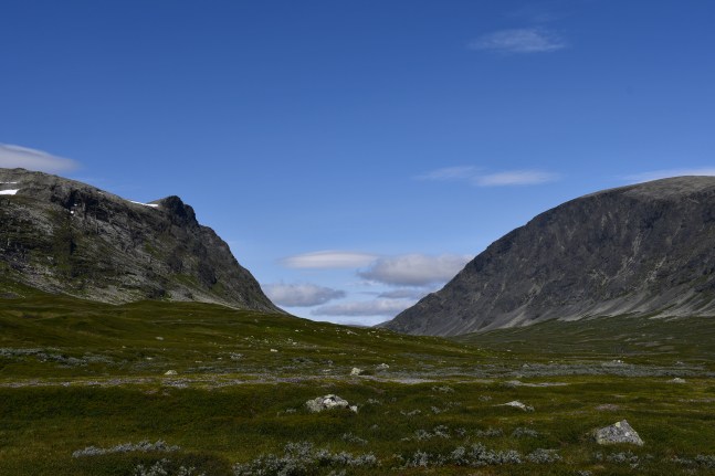
Objective(s): Storådorren, a mountain pass between Nörder-Storådörrfjället and Synder-Storådörrfjället.
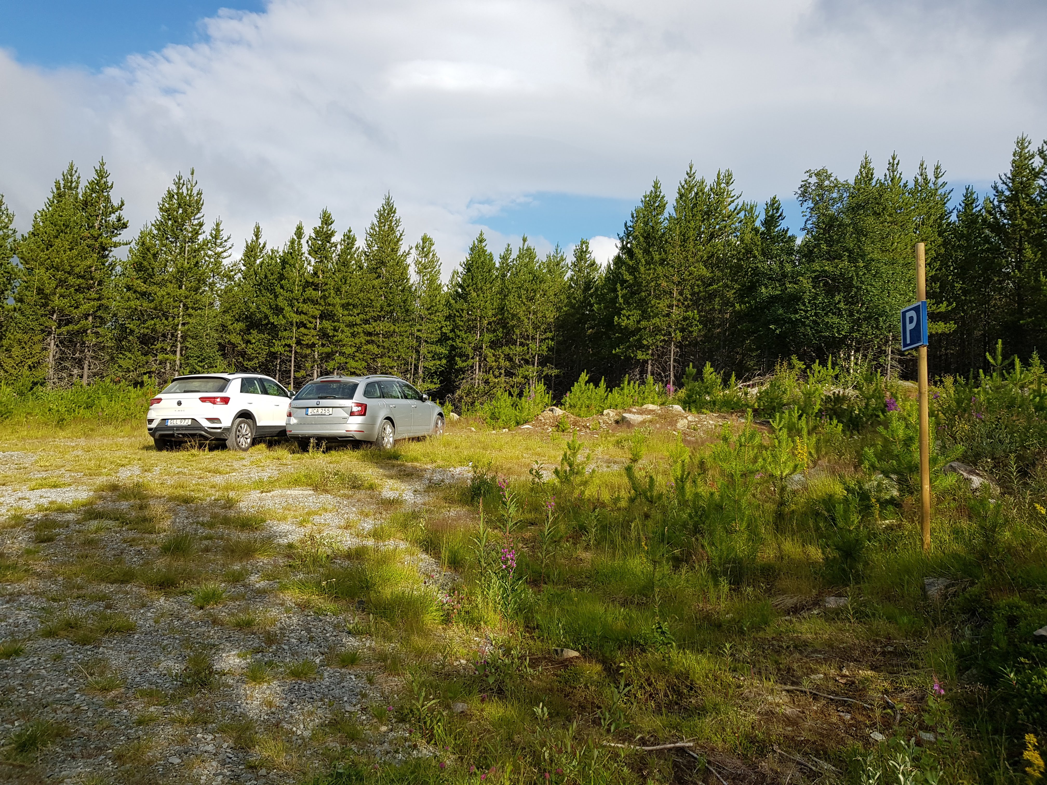
Since we slept quite early, we were up as early as 0430 hours. It was still quite cold outside(10 degrees or less) to begin a hike. I insisted on starting as soon as possible but DJ was a bit unwell, also he was averse to step out in the cold. I was apprehensive about losing time. We lazed around, had our breakfast, took out our light backpacks, and started from the hostel around 0730 hours. The farthest point till which you can take the car is Nordsätern(28km from Ljungdalen) but there is almost no parking space there, moreover, the residents(there are 6-8 summer houses) face hurdles, as parked cars block their way. Based on the pointers of the previous travelers, we decided to park at Halvfare parking. It is 2.5km from here to Nordsätern.
Note: From the main road, Nordsätern is 9km. This entire stretch barely accommodates one car. Drive slow, keep an eye for places where you can place your car to let an oncoming vehicle pass. You or the other driver might need to reverse as much as 500m to find an appropriate place. My suggestion – start the trek as early as possible! I checked the clock – 0810 hours. As per my view, we were running almost 2h late.
While walking on a gravel road towards Nordsätern, at least 4 young ones of a fox kind popped up at a corner ahead. Before we could get a clear sight, they disappeared in the forest. I was unsure if they were Artic Foxes(Svenska: Fjällräven) or the Red Foxes. I convinced myself that they were the latter because 1) The Artic Foxes are not only rare but also a hunted by the Red Foxes. 2)Artic Foxes are mostly spotted deep in the wilderness, it was unlikely that they would have ventured in an area with human population and cars. I heard a helicopter flying nearby but couldn’t spot it.
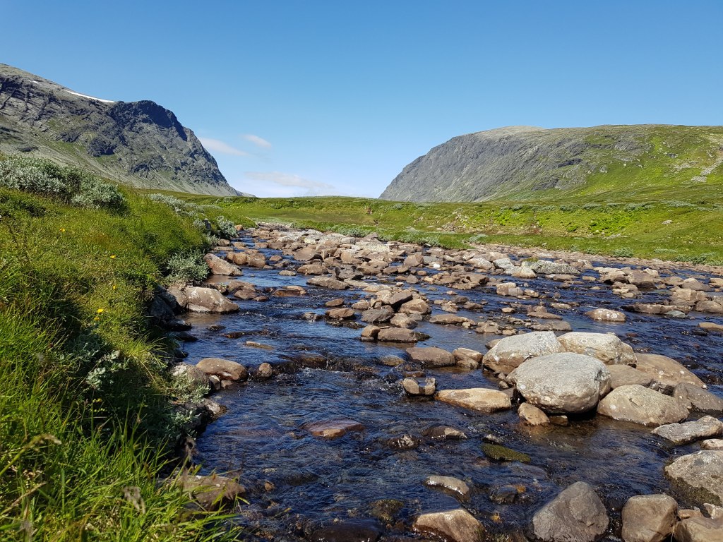
A gentle stream of the river Storån(several rivers of the same name exist in Sweden) was flowing on our right since we started to walk from Halvfare. As we reached Nordsätern, we could see some houses on the left. We met an elderly Swedish lady who owned more than half of the houses there. She provided the following information:
– The helicopter that I heard was now visible. The Swedish authorities were searching for Gold, Copper, and a radioactive metal using a radar technique. The helicopter had been circling the landscape since 0700 hours (and would continue at least till we returned from there). The lady was upset since it would mean destruction of the area, as the mining companies would take over.
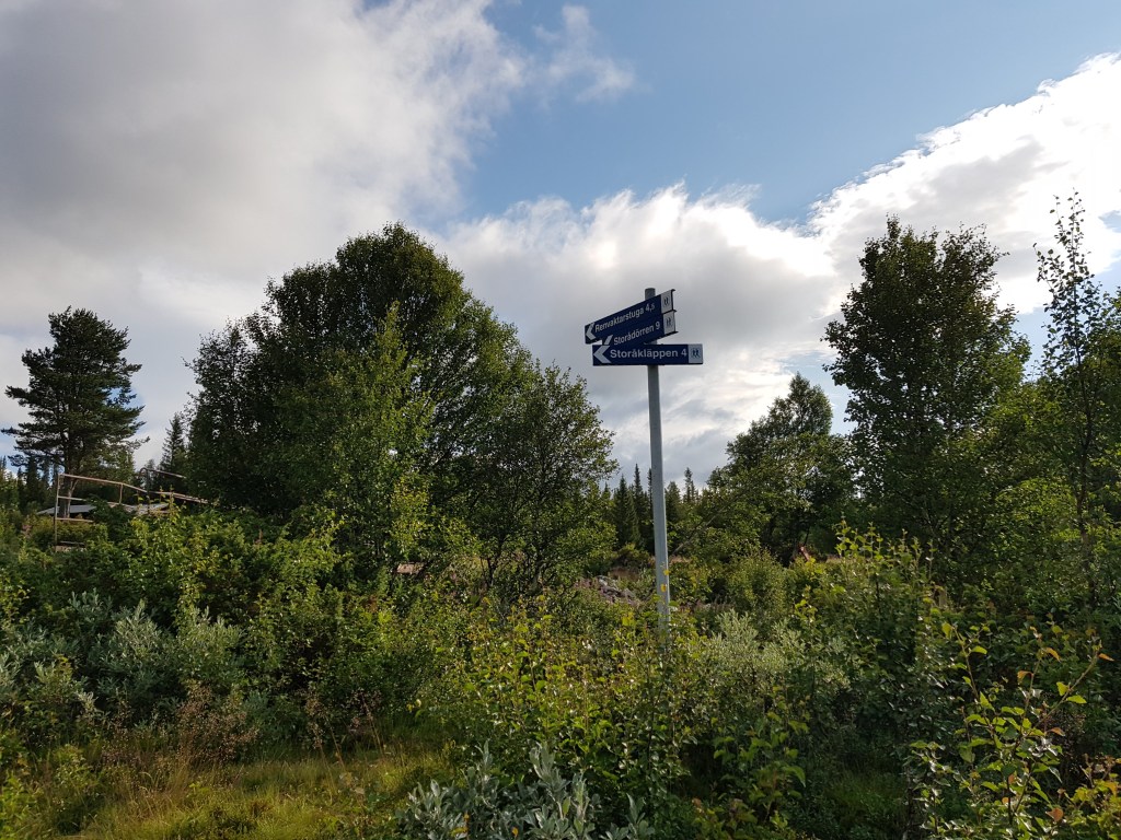
– The trail was marked only till a Sami hut that lied en route Storådorren(around 10km from Nordsätern). Beyond that lied pristine wilderness. We asked us if we can reach the summit of one of the two mountains forming the Storådorren. She said that if we were having food supplies and willing to stretch our day till the daylight lasts, we might be able to do it. DJ immediately discarded that possibility while I had a glimmer of hope.
– She redirected us to a way that goes in the woods, thereafter, to Storådorren. As with a typical trail in Sweden, orange, red coloured spots are marked on trees, rocks, and one should not miss these.
After walking for around 45 min. in the woods, the landscape changed and the wilderness opened up. It was still around 12-13 degrees, we had our wind-cum-rain jackets on. Strong and cold wind was now hitting us as the woods were disappearing and we were headed to the open and terrain.
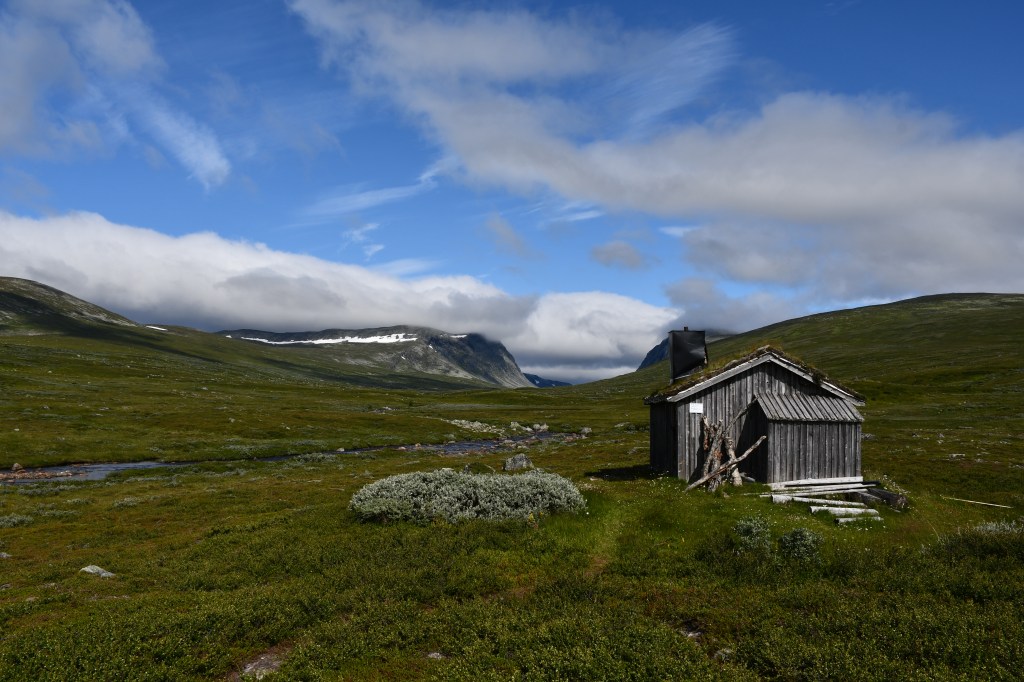
The stream I mentioned earlier, now had started to widen. The trees disappeared, now it was only shrubs and grass. While the trail was still trackable, it was swampy around. The water of the stream was cold and fresh. We soon reached the Sami hut. It is a private residence. It was empty when we reached there. Note that even if someone is there, it is advisable to move on. Samis don’t like visitors intruding their hard work pertaining to reindeer husbandry.
It was almost 1000 hours. Winds fell a bit but it was still cloudy, and cold enough to keep on the jackets. We gulped half of our lunch(good old bread and omelettes). DJ wanted to return but I wanted to attempt the summit. We decided that DJ would wait and rest near the hut, and I would go ‘a bit farther’. We soon realized that the lady’s information was accurate – not only the trail ended at the hut, every metre of walk henceforth was tedious and a bit treacherous. In case you wish to reach the summit of one of the mountains forming the Storådorren, note:
- Apart from other provisions, carry two, full meals.
- As mentioned earlier, only shrubs exist in this landscape. The mountains in this region are barren. As the snow slowly melts, countless small streams flow down from the mountains, and spread freely on an open landscape. The result – every 10 metres, there is marsh, most of the times, concealed under blackish-appearing grass.
- Where there is a bit of soil, shrubs grow waist high, concealing deep ditches. This not only makes walking an ordeal but also mentally trying as you have to examine your way towards the summit every 10 metres.
- At least I didn’t see a single human being other than the elderly lady in Nordsätern. Network died as I approached the pass.
- It seems that staying on the right(Nörder-Storådörrfjället, the mountain on the right-hand side) provides an easier way but it’s an illusion. Both the mountains are surrounded by marshes, it takes a lot of energy to even reach the base of a mountain.
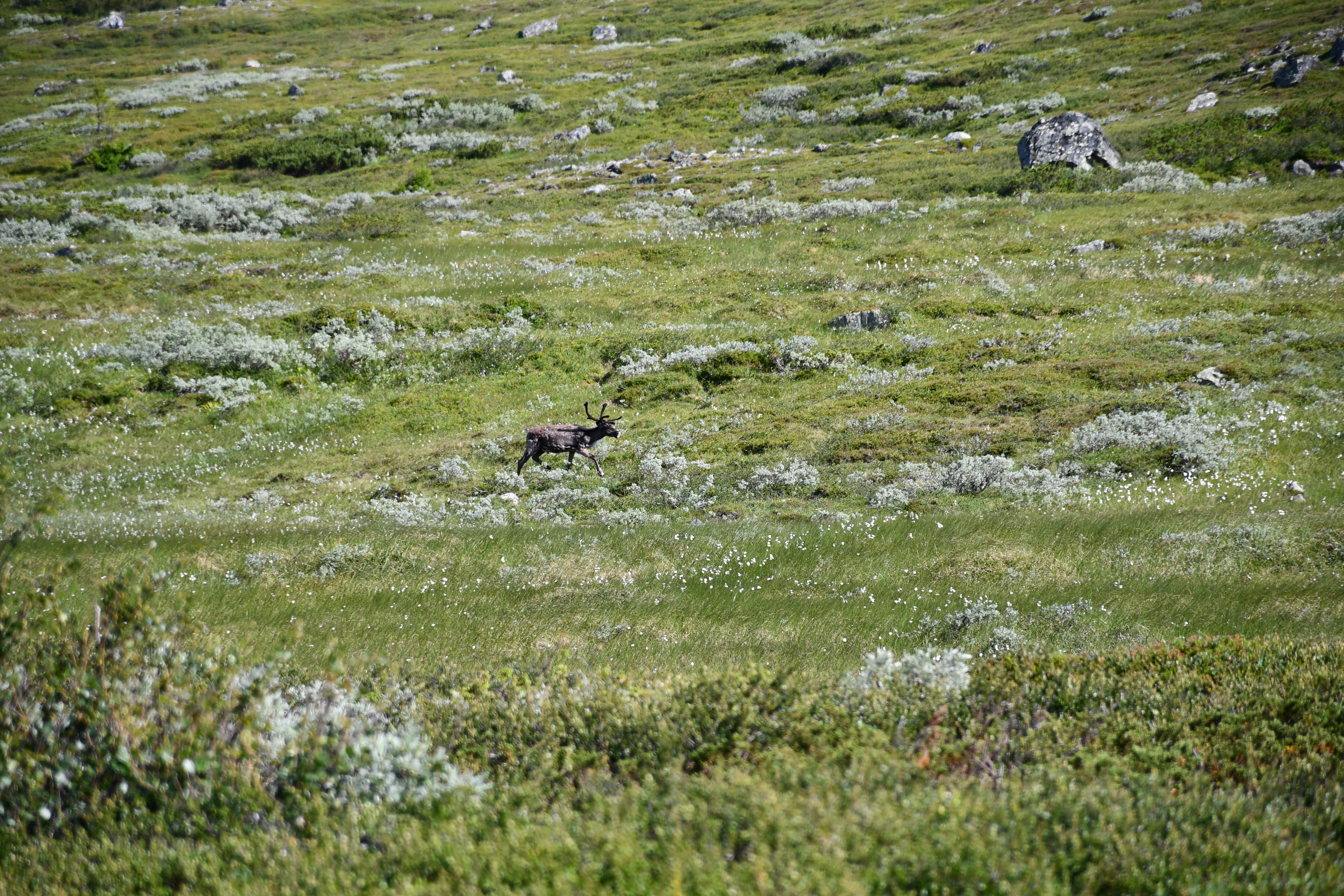
We finally made up our mind, and crossed the stream. While it’s not deep, we were too lazy to remove our shoes and cross it barefooted. DJ continued advancing with me for some minutes, then decided to retreat. I was adamant on attempting the summit. It was decided that DJ would wait near the hut and I would proceed alone. I mustered motivation and courage, and marched ahead. Within few minutes, I saw a reindeer approaching. Probably, it was separated from it’s herd. As soon as it spotted me, it took a detour and raced away. It was a loveable experience to spot a reindeer in wildernesses.
Finding a path ahead was getting difficult. I avoided crossing the stream over and over.
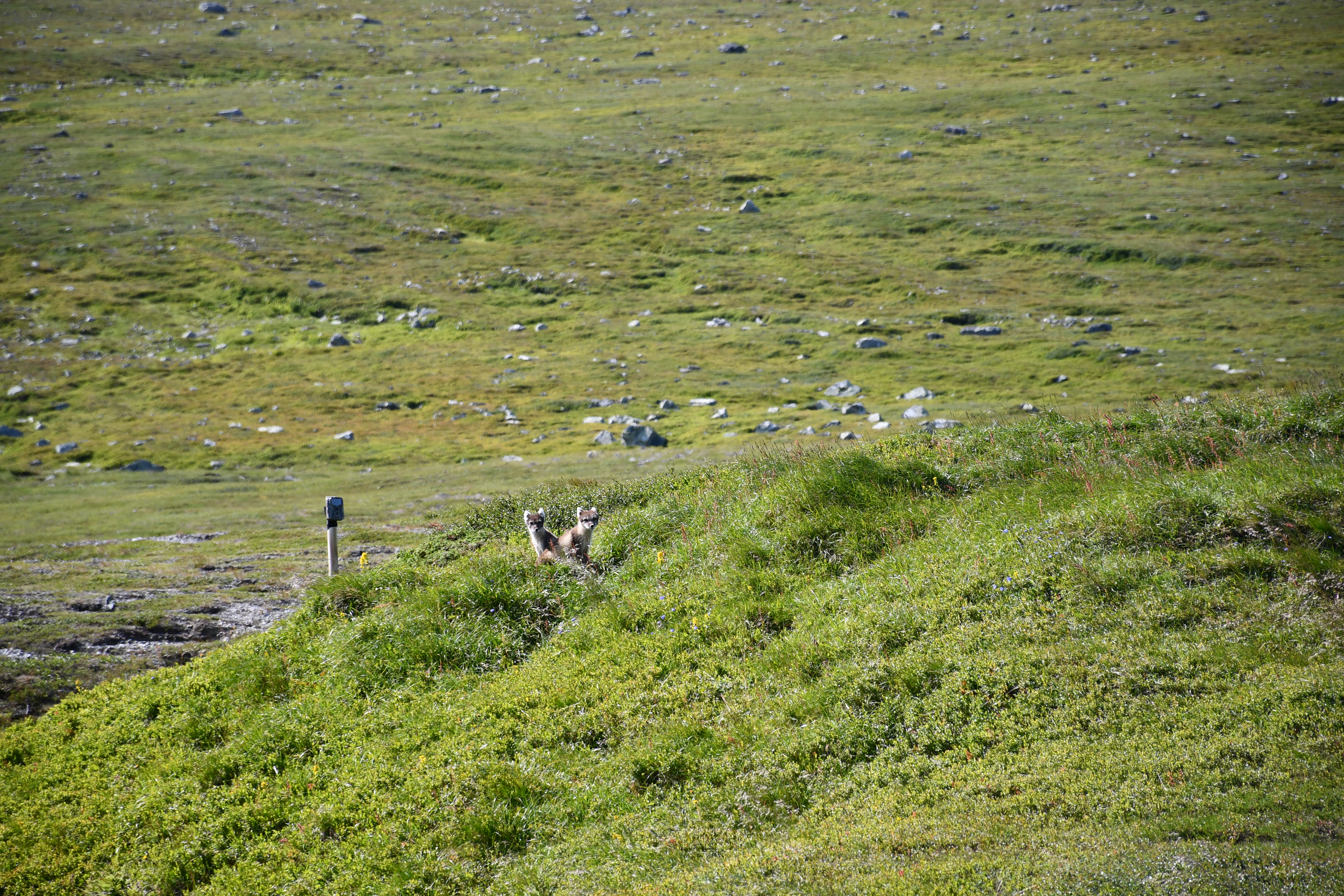
There were mounds everywhere. I could barely cover 1km in 40 minutes. While I was worrying about the pace, I suddenly noticed some moment on my left. An Artic Fox family was staring at me – two adults(possibly, a pair), and at least 3 young ones. I was jubilant, and in that excitement, I quickly moved in that direction to get a better look. The young ones scurried into some hole/burrow, and were gone !!! Both the adults now took a guarding position and were observing me. I slowly retreated and started to circumvent them. I took out my camera and hastily clicked a few shots. Soon, an adult disappeared, the other one stood guard. I decided not to intrude further, and proceeded my way towards the summit.
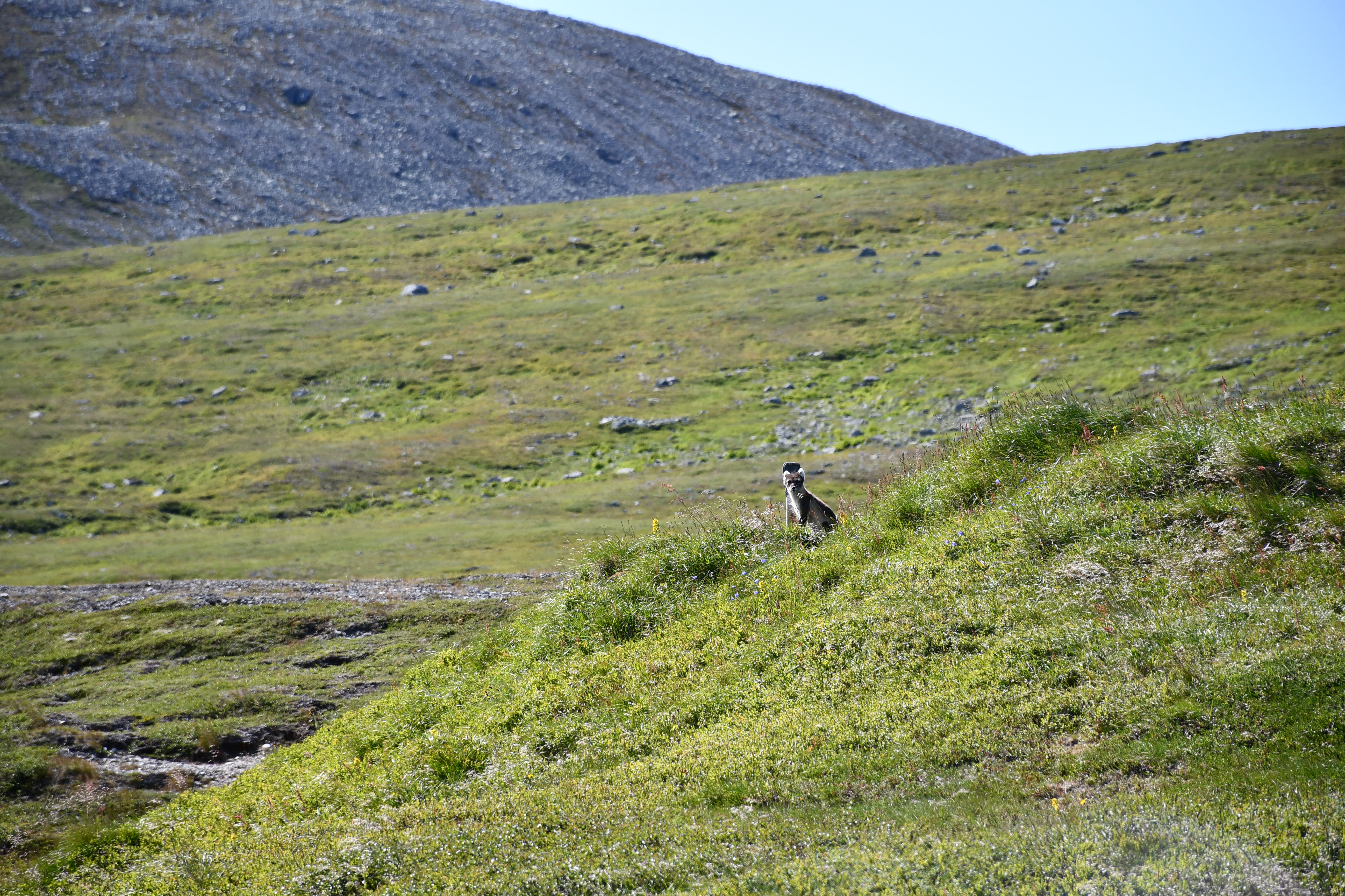
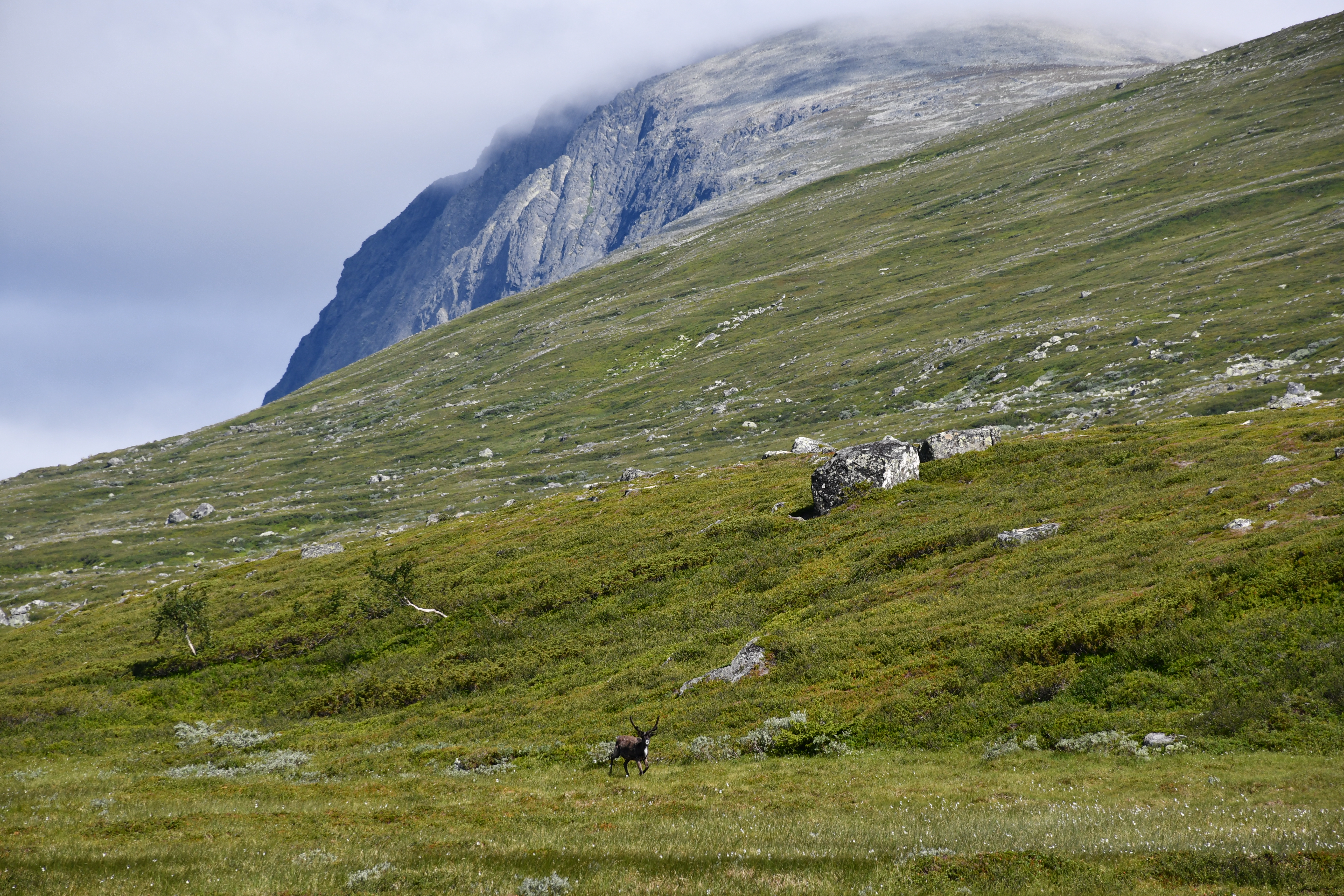
I had now almost reached the base of the mountain on the left. At this point, my mind was in an ambivalent state – the sheer wilderness, spotting of animals in there habitat, the barren mountains, the open landscape filled with marshes pleased my senses, however, the strong and cold winds blowing from the pass, intermittent cloudiness, no sign of life around(even the few birds that I saw earlier had now disappeared), and being alone made me a bit nervous. The phone’s network had now died off, also, I noticed that I had missed a couple of calls from DJ.
I started to rush towards the mountain but there was simply no way – just an unending labyrinth of marshes. After struggling for 2h, I decided to abandon the trek to the summit. It was almost 1330, and the summit would take at least 2h to and fro. My legs were already aching due to stumbling and jumping across the swamped ways. I took a final look at the pass, and blew the retreat trumpet.

As I retreated, I grew grumpy, later, sulky. I couldn’t accept the fact that I had missed the summit. I stumbled and staggered my way towards the hut, while DJ was calling to check how far am I from the hut. By the time I reached it, it was almost 1430. I gulped the remaining bread and omelette, relaxed my limbs a bit, and we started to head back to Nordsätern. I was falling behind(something that would become a norm 😶), hence, DJ suggested that I should wait at Nordsätern while he would go to Halvfare, and return with the car, thus reducing my ordeal by 2.5km. Meanwhile, I called up the STF Helags Fjällstation reception and requested dinner reservation for the next day. Alas! They were fully booked since the past fortnight 😦

Nordsätern – Sami hut: 4.5km.
Sami hut – (almost!) base of Synder-Storådörrfjället: 5km or more
I waited for DJ for quite some time at Nordsätern. Finally, he arrived, and we left around 1700 hours. While driving, I suddenly noticed several youngsters, either in pairs or solo, on roller skis. Further down on the road, tiny traffic signs were put up to warn the drivers about skiers practising. I was left wondering about this event. When we reached the hostel, I asked Eva about it. She clarified that professional skiers, and students aiming to become professionals train hard during the summer. They run uphill and downhill while their coaches monitor their performance and stamina. Later in the evening, I saw several teenage girls checking-in with their roller skis and other gear. Eva said that they had traveled here for training. More students would be coming.
Our state wasn’t really sound enough to cook and eat, we booked a seat in the only (then known to us) restaurant for 2030 hours. We took a sauna, followed by a shower. To our disappointment, the restaurant was serving only pizzas. It was overflowing indoors, so we had to sit out in the cold, and hog our pizza. The next day, we were supposed to walk up to the Helags fjällstation. We decided to have a good sleep, start a bit late, since 12km seemed an easy walking target for the day.
Distance: 23km(walking) + approx. 60km(driving)
Day-3
July 22, 2021(Thursday)
Objective(s): Walking(12km) from Kläppen to the STF Helags Fjällstation.
My toes were sore, thanks to the shoes. The pizza hogging during the previous dinner hadn’t gone well for our stomachs, we daringly decided to skip the lunch, and survive on quick bites. We prepared breakfast and took our time finishing it. Eva gave us a piece of dried Reindeer meat, as a compliment. She explained the process of how the meat is dried in a traditional way:
- Hunting often takes place in the winter. The fresh meat is cleaned, salted, and naturally refrigerated in snow for few weeks.
- In an enclosed area, the meat is hung high, and smoked using the wood from the Birch(Svenska: Björk) trees. Apart from drying the meat, the smoking gives it a scent and flavor of Birchwood.
- The smoked meat is now hardened, and can be used without any preservatives. It can be further cooked but traditionally, it is eaten as-is, while on the move.
We started quite late(0945) from the hostel. Kläppen was barely 6km. When we reached the parking, several surprises awaited us:
The weather was not only colder than we expected, but the wind was so strong that we got swayed, if we stood still. I was eager to hit the woods for cover. Like Storådorren, the landscape here was expected to be open, and these winds would hurt a bit.
We found a spot, DJ got the parking payment receipt. While trying to place it on the dashboard, it fell in the gap between the dashboard and the windshield. There was no option other than taking a new receipt. A man who just parked his car besides us met the same fate, and we all were laughing at our clumsiness 😂.
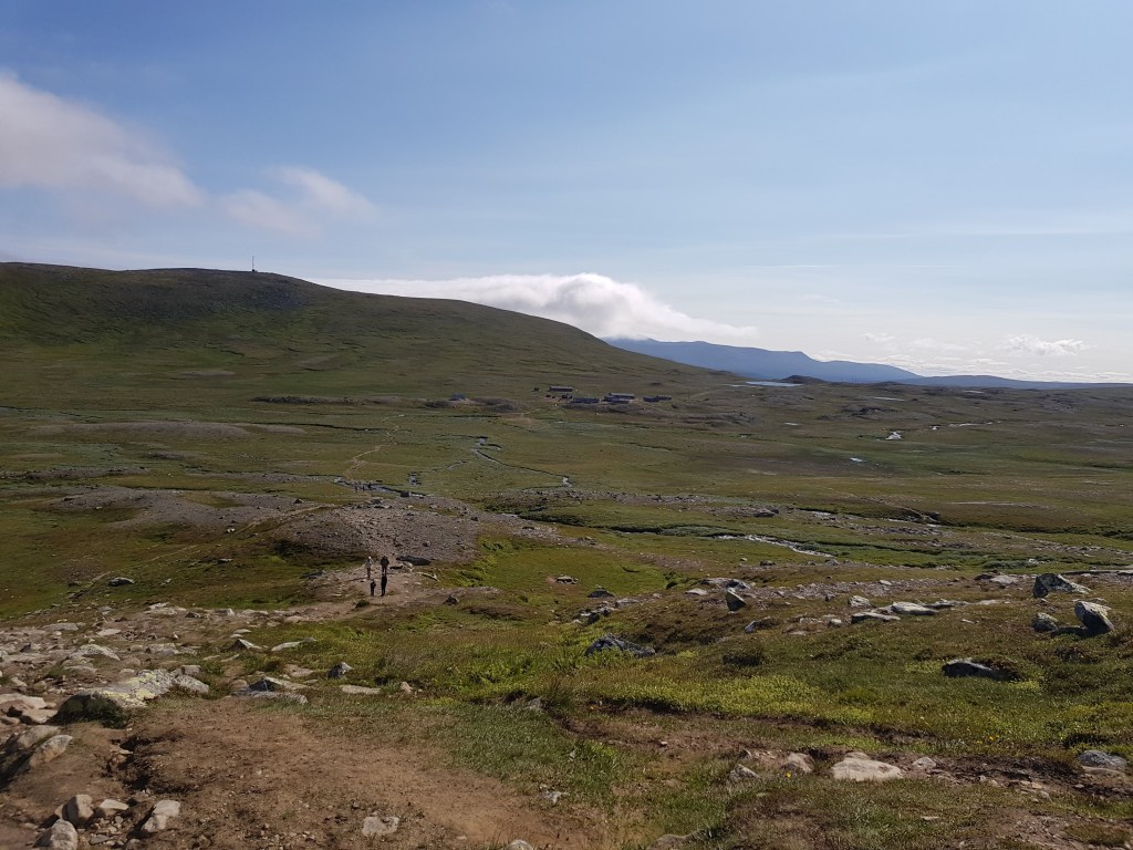
After experiencing the winds and the cold, DJ panicked, and we rushed back to the hostel to fetch insulated/thermal clothing. I already had these in my bag but I decided not to wear it on my torso, as it would cause overheating. Nevertheless, I got influenced by DJ, and put on the thermal pants, and then my regular trekking pant. We returned to the parking, did the honours of paying again, and left the motorable road. With us, at least 50 persons started the walk. There were several families with 2-3 kids aged from 4 to 12. Many elderly couples, elderly friends(duos), and some groups of sturdy men. Two ladies(55+, they told me later), along with total 3 dogs, started with us. It was past 1100 hours by the time we started the walk. A couple(they were also our co-guests at the Ljungdalen STF) with their almost 2-year old son were hiking. The infant was initially reluctant to sit in the hiking carrier backpack, but I think he soon fell asleep :D.
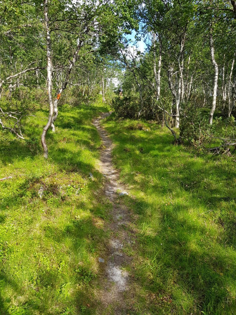
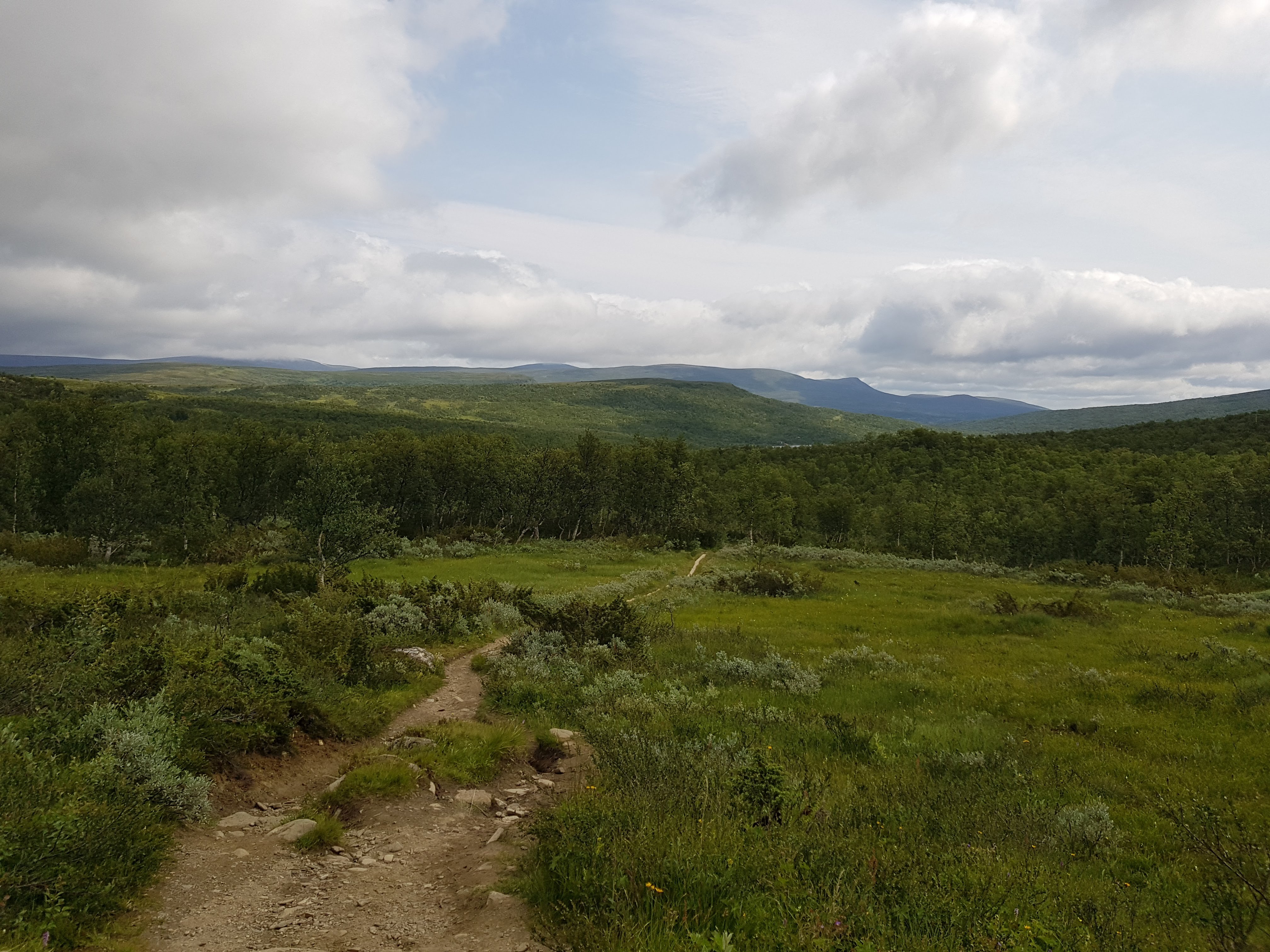
The route started with a gravel road which is used by the hikers, and the people living in the cottages ahead. There are aplenty villas for the next 1km or so. After Kesusjön, woods start appearing. After leaving behind few more houses, one is amidst the woods. The path has some mud and puddles at places, hence, wooden planks are placed to make walking easier. In the woods, the path is narrow, hence, the hikers often have to take turns letting the other side pass.
In less than 30 minutes, we started to feel uncomfortably warm due to the thermal pants. I stopped midway, and removed it out in the open. DJ mimicked me, and soon we felt cozy. It was still windy, but the clouds were clearing up, blessing us with sunrays. DJ gobbled a protein-bread sandwich, I sufficed on some sweets, and the dry-fruits bar prepared by my wife. Some hillocks popped up, clearing those took me more time than expected, that is when I realized that the backpack weighing above 13kg was beyond my capacity, if I intended to walk briskly. Soon, DJ and I decided that he would march ahead, complete the check-in formalities, while I reach there at my own (snail’s) pace. Unlike Storådorren, there were hundreds of people going towards/returning from Helags, so there was no fear of treading alone.
Gradually, the woods disappeared, and the landscape turned vast and open. First shrubs, then grass and weeds were visible i.e. the vegetation was shrinking. The winds were now strong(33 kmph), and flowing in the opposite direction. It further slowed down my advance – it felt like I was wrestling, and trying to push back the opponent.
One fact to note is the colour/marking style of summer and winter trails. The winter trail is often uneven, longer, and more laborious to walk in summer, so stick to the summer trails.
The walk was quite uneventful – greeting the fellow hikers, facing the incessant winds, occasional gradients and slopes, a stream, and so on.

DJ reached by the hostel by 1415 hours, and gave a notification call. I raced on, soon, the hostel was in sight. I made it by 1445.
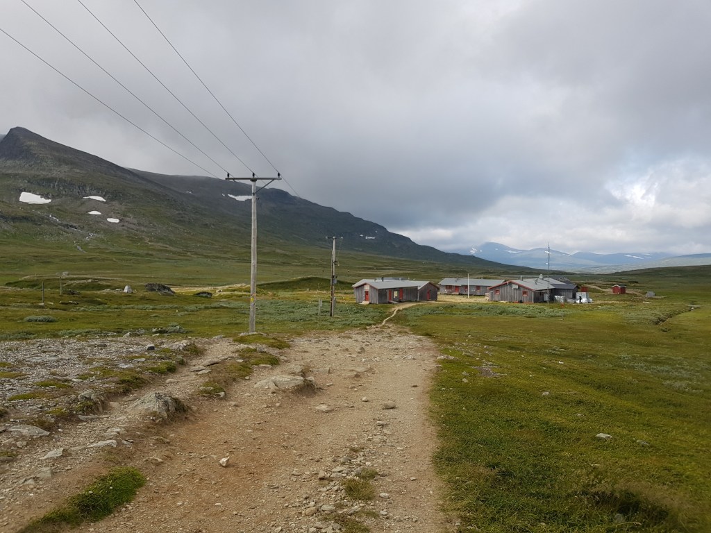
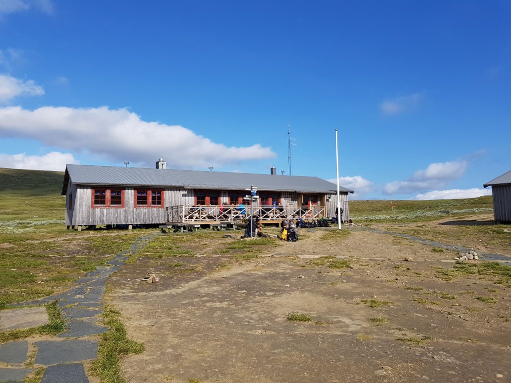

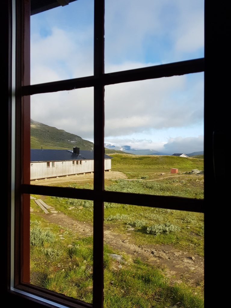
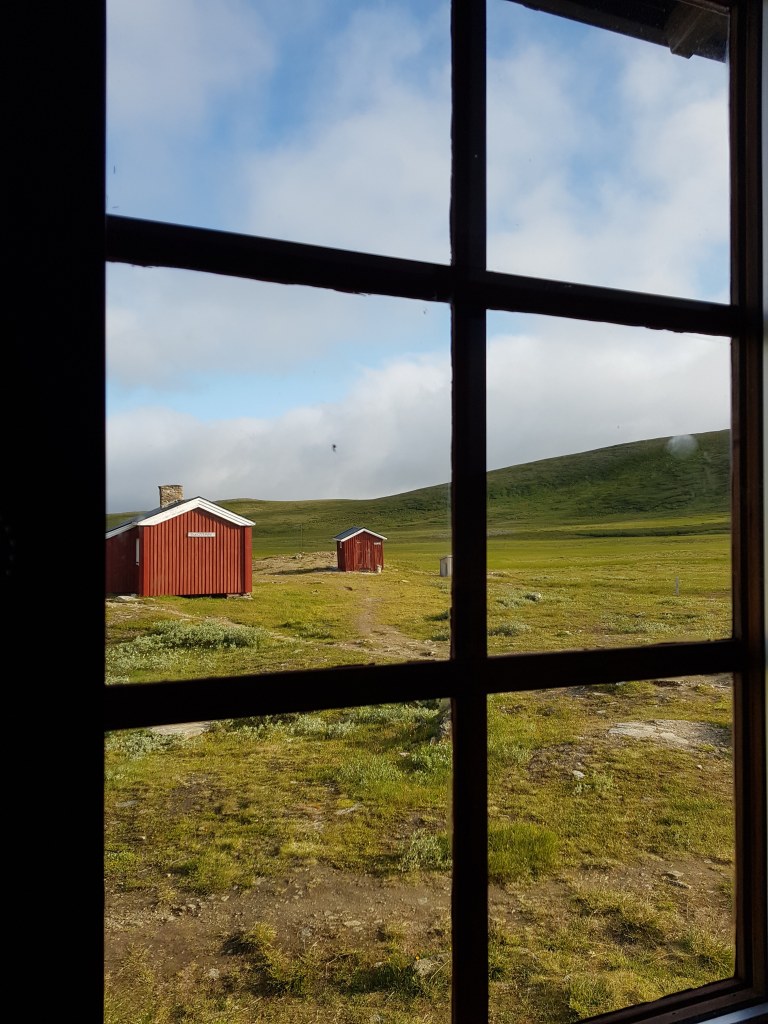
It was colder here, the winds stayed strong. There were at least 20 tents in the vicinity of the hostel. The hikers passing by, the campers can use all of the hostel’s premises(I didn’t inquire if there was a fee for this) – toilets, kitchen, etc. except the rented rooms. The dining area was spacious and inviting, but as mentioned earlier, we didn’t get a dinner booking. It is advisable to book the dinner while booking the room.
Our room was having 4 bunk beds, we didn’t get a smaller room. The couple with their 2-year old infant were our neighbours here as well. Note that the rooms here do NOT have locks, hence, keys are not provided to the guests.
The kitchen was overflowing with campers, so we decided to wait a bit. The man whom we met in the parking was also present there. He was accompanied by two kids(aged around 10), and his father. They were going to stay in a tent. I was quite impressed with this family camping practice. In spite of not having lunch, I wasn’t hungry. We still went to the cafeteria for a fika. I relished an apple pie, while DJ tasted a chocolate cake. I rested my limbs a bit, then headed to the common showers. The toilet and showers were located in a separate cottage, one has to walk a bit. We decided to rest a bit, and by 1700 hours, DJ fell asleep. I was somehow unable to sleep. I pruned the list of the captured photos, took some notes, and awaited DJ’s rise from slumber. I revisited the reception to check if any spots for dinner have freed up, in vain! I booked breakfast for both of us, for the next morning. I opted for the 0700 – 0745 slot. The other one was 0800 – 0845.
Disappointment struck soon – we had forgotten edible oil. We didn’t even bother to check if it was available in the hostel’s store, we simply resorted to Maggi, yet again.
The weather forecast for the next day was windy, and the cold and the clouds would recede only after 0930 hours. I was apprehensive – this meant a late start, and owing to my pathetic fitness(!), I would have to complete the summit + walk back to Kläppen, without much rest. I had no options, and I decided to go with the flow. We dozed off by 2200 hours.
Distance: 12km(walking) + approx. 20km(driving)
Day-4
July 23, 2021(Friday)
Objective(s):
1. Helags summit
2. Walk back to Kläppen
After the morning chores, we had the breakfast served in the dining area near the reception. It was a typical Swedish breakfast buffet, and we stuffed our stomachs as much as possible, since the day was going to be a long one!
Even though we were ready to roll by 0800 hours, we started to walk around 0945. It was still windy and cloudy, but looked promising. Aplenty fellow hikers had the same plan – wait for the weather to improve, reach the summit, descend, and have some rest at the fjällstation, and walk back to Kläppen. Even those ladies(aged 55+) that I met yesterday had the same plan.
We cleaned the room, and checked out(well, there was no question of returning keys). We slid our backpacks under the seats in the kitchen.
Don’t get fooled by the cold weather and the presence of ice-water streams – carry enough water to the summit.
The trail is marked quite well till the actual glacier begins.
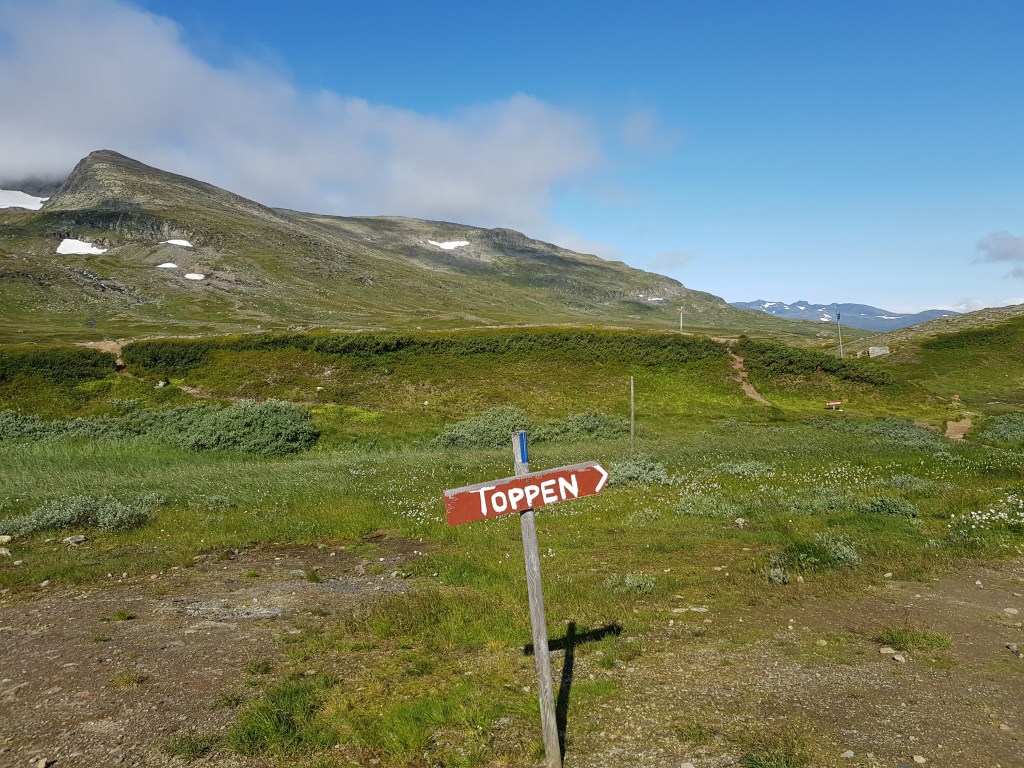
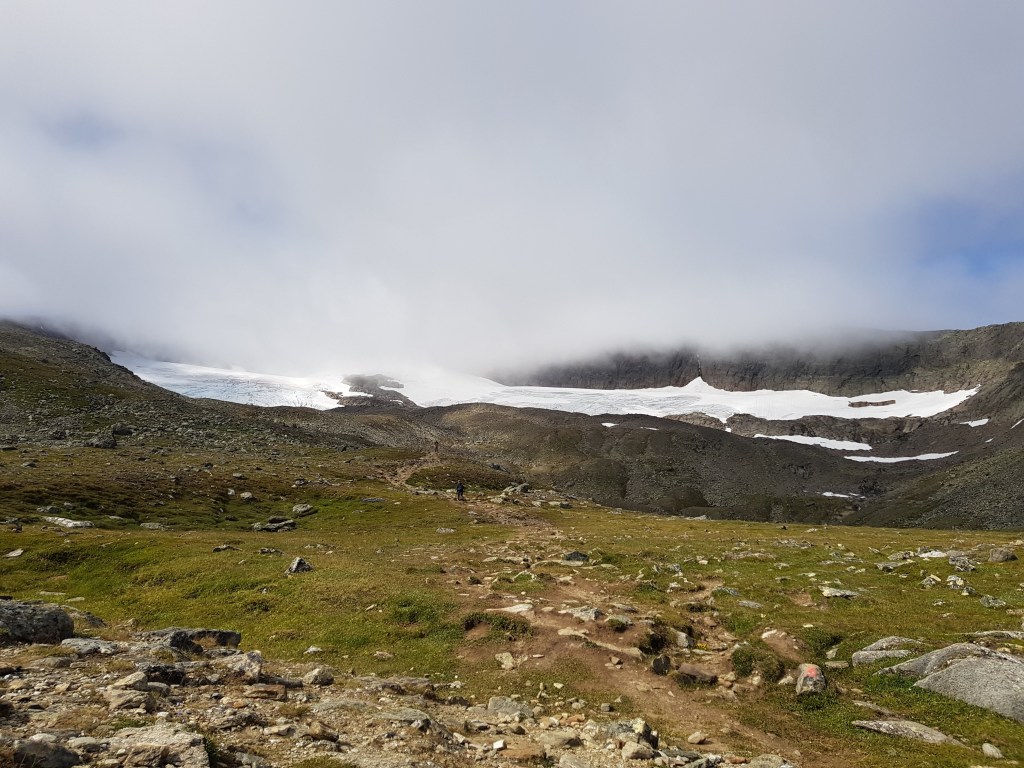
Most of the climb is along the eastern face of the summit/glacier.
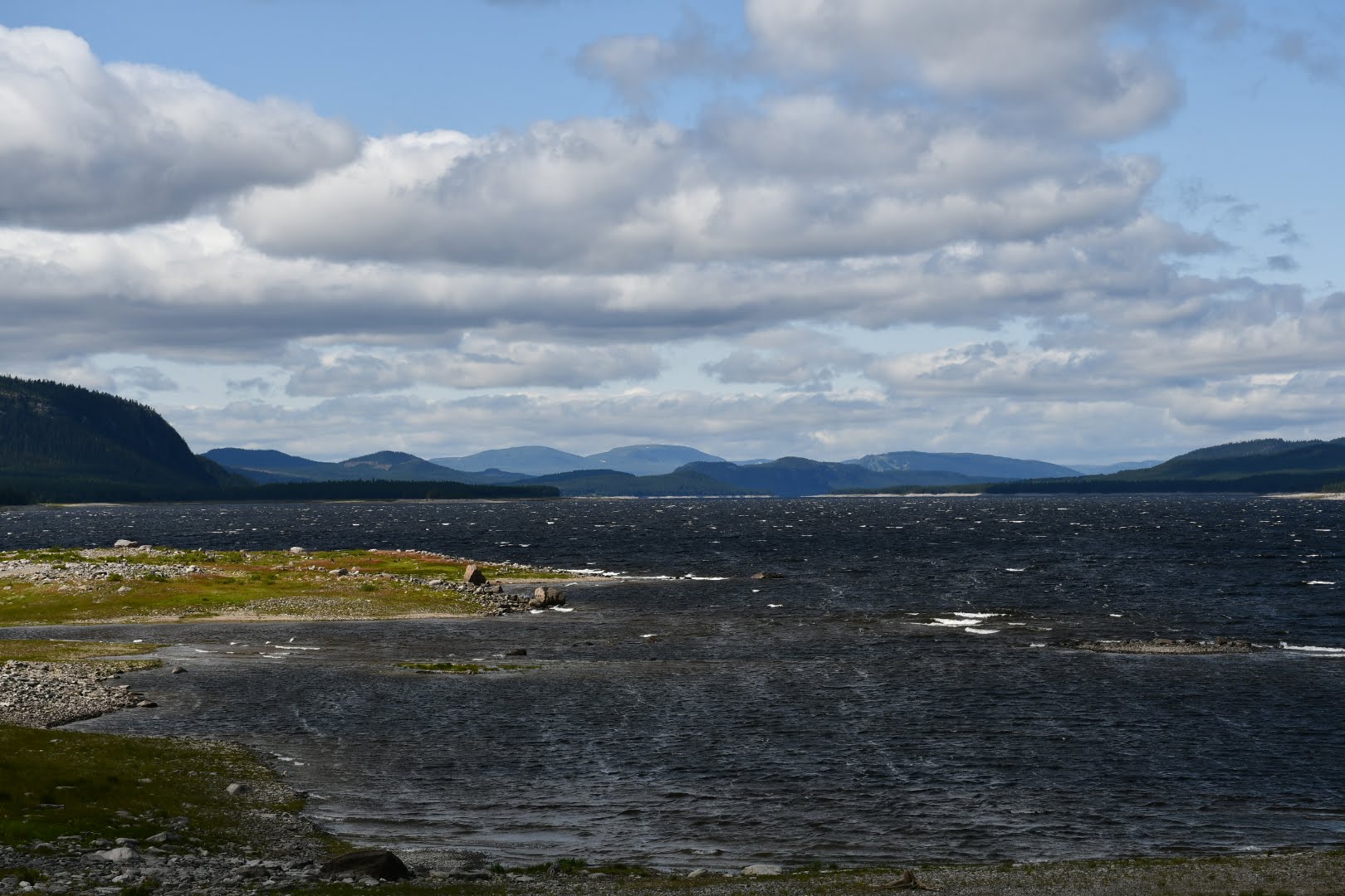
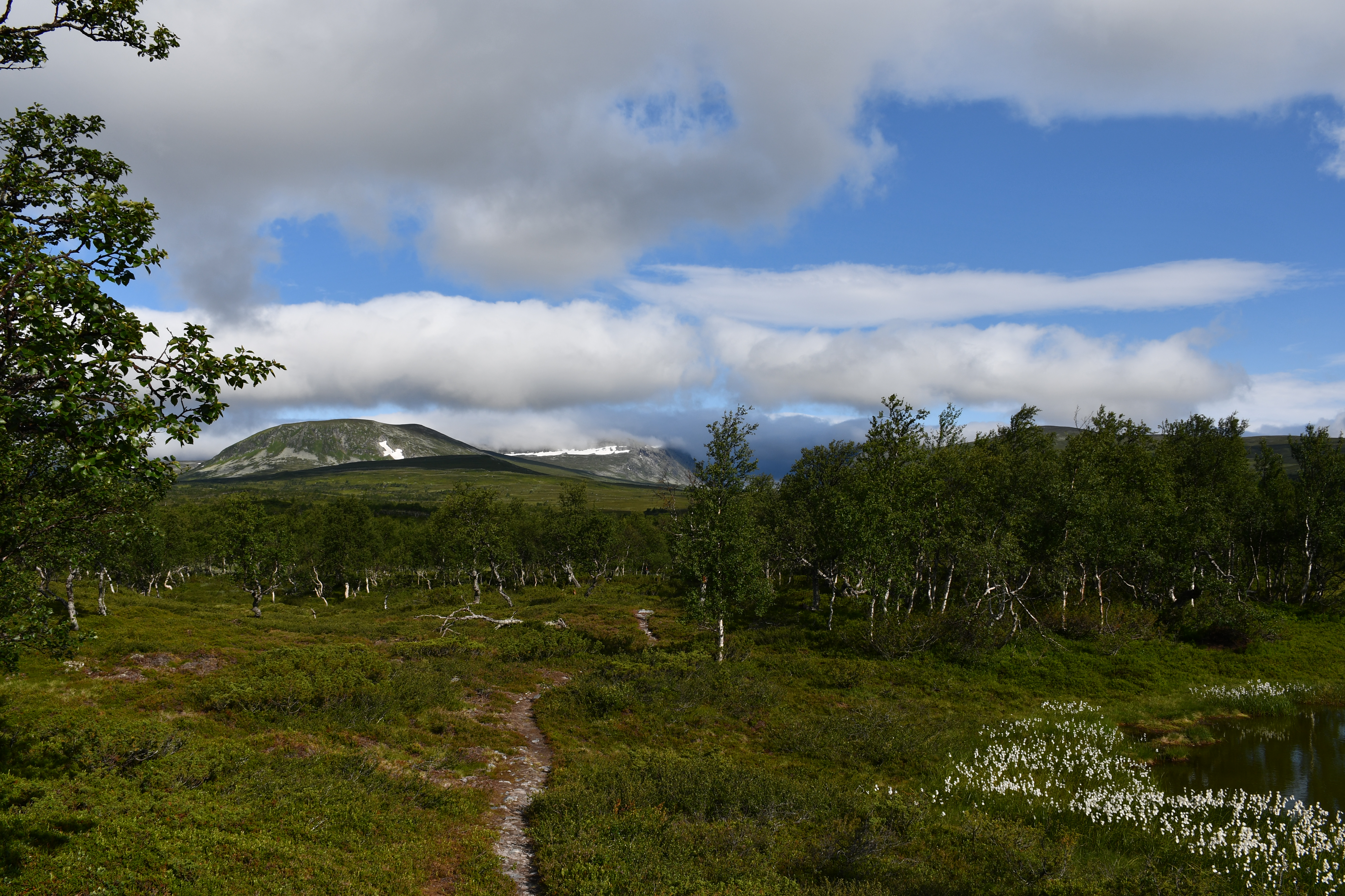
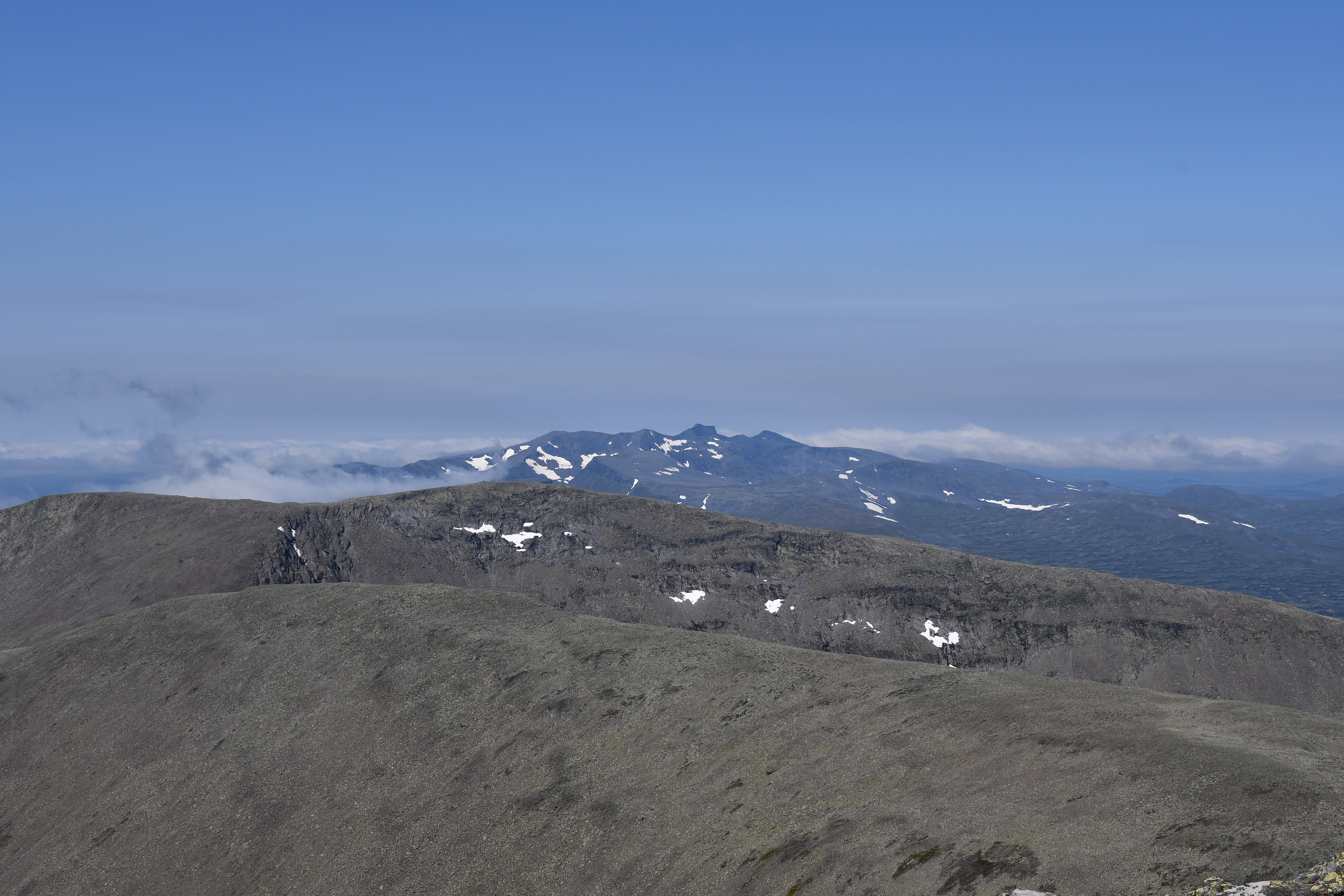
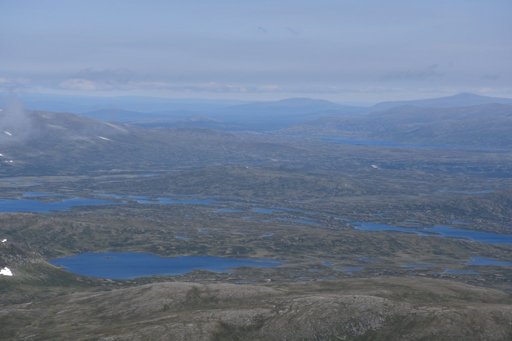
After some time, DJ marched ahead while I laboured my way up. By the time the path flattened a bit and turned northwards, it was 1200 hours. I was quite exhausted by then but at least the wind had stopped, it was quite sunny, and an enchanting view of Sylsjön opened up:
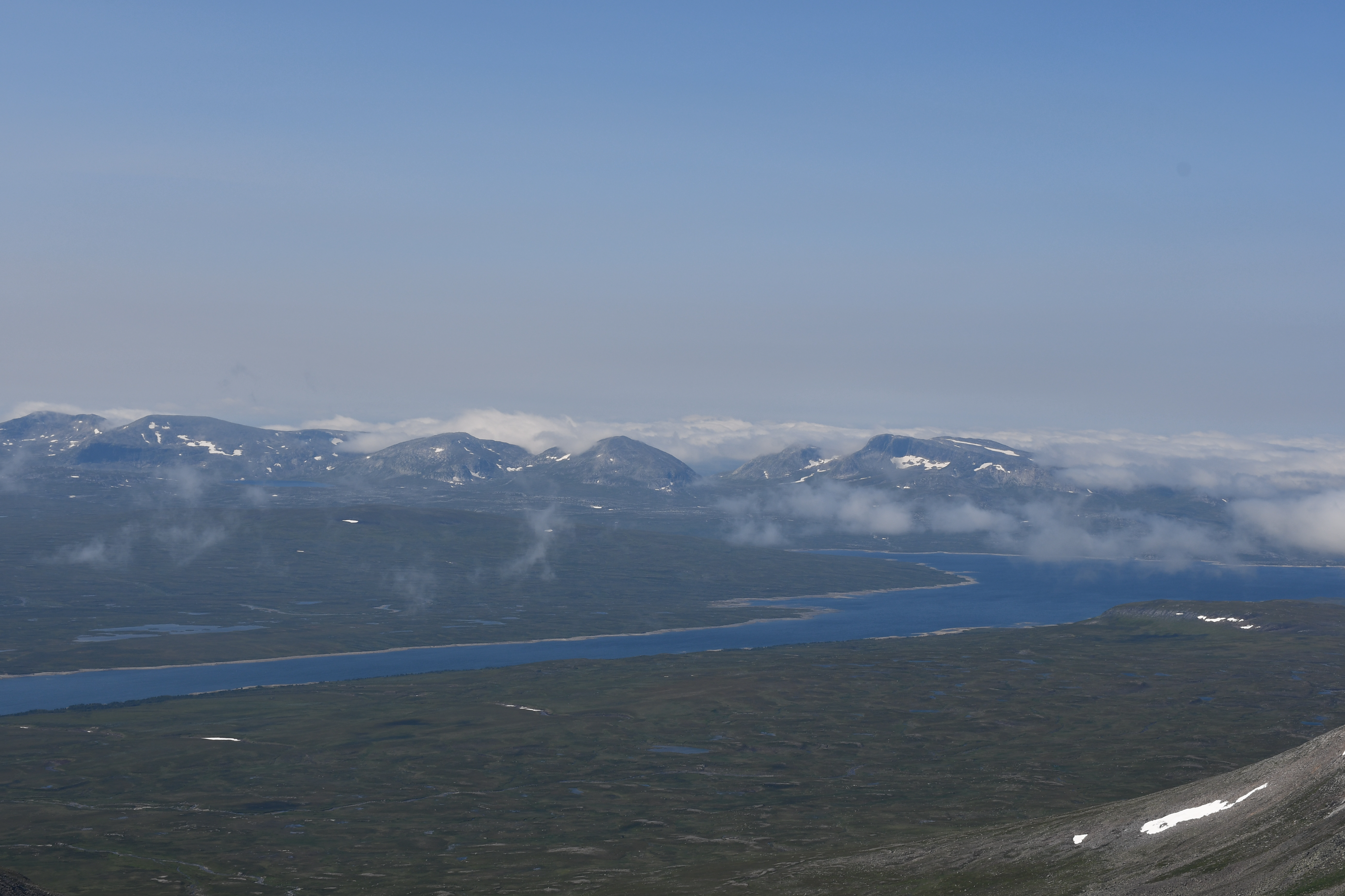
The southern side of the Norwegian part of the Scandinavian mountains can be seen in the photo. Sylsjön is an artificial lake created in the 1950s. It serves as a catchment area for the watercourse named Nean. Nean flows down the slopes where the flow is utilized to rotate hydroelectric turbines. It further feeds the Nidälven river that flows via Trondheim.It was built by an energy company in Trondheim after it received permission from Swedish authorities. Trondheim was earlier known as Nidaros. A pilgrim trail from Sweden ended here, and when the dam was built, a part of this trail was submerged in the lake.
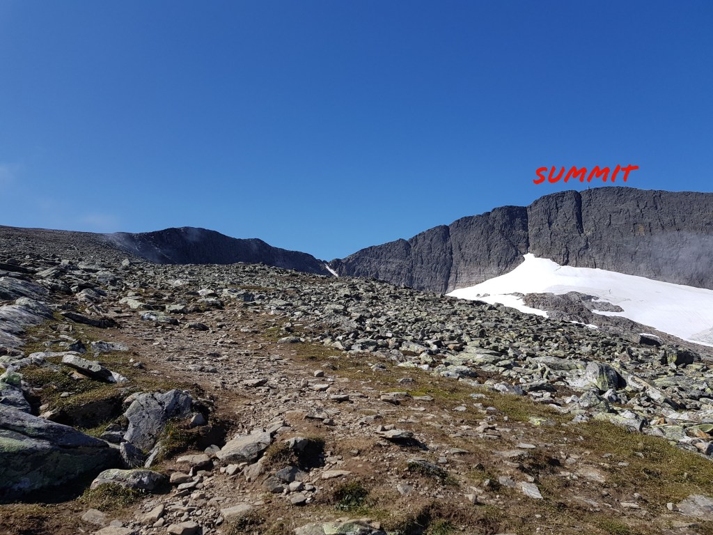
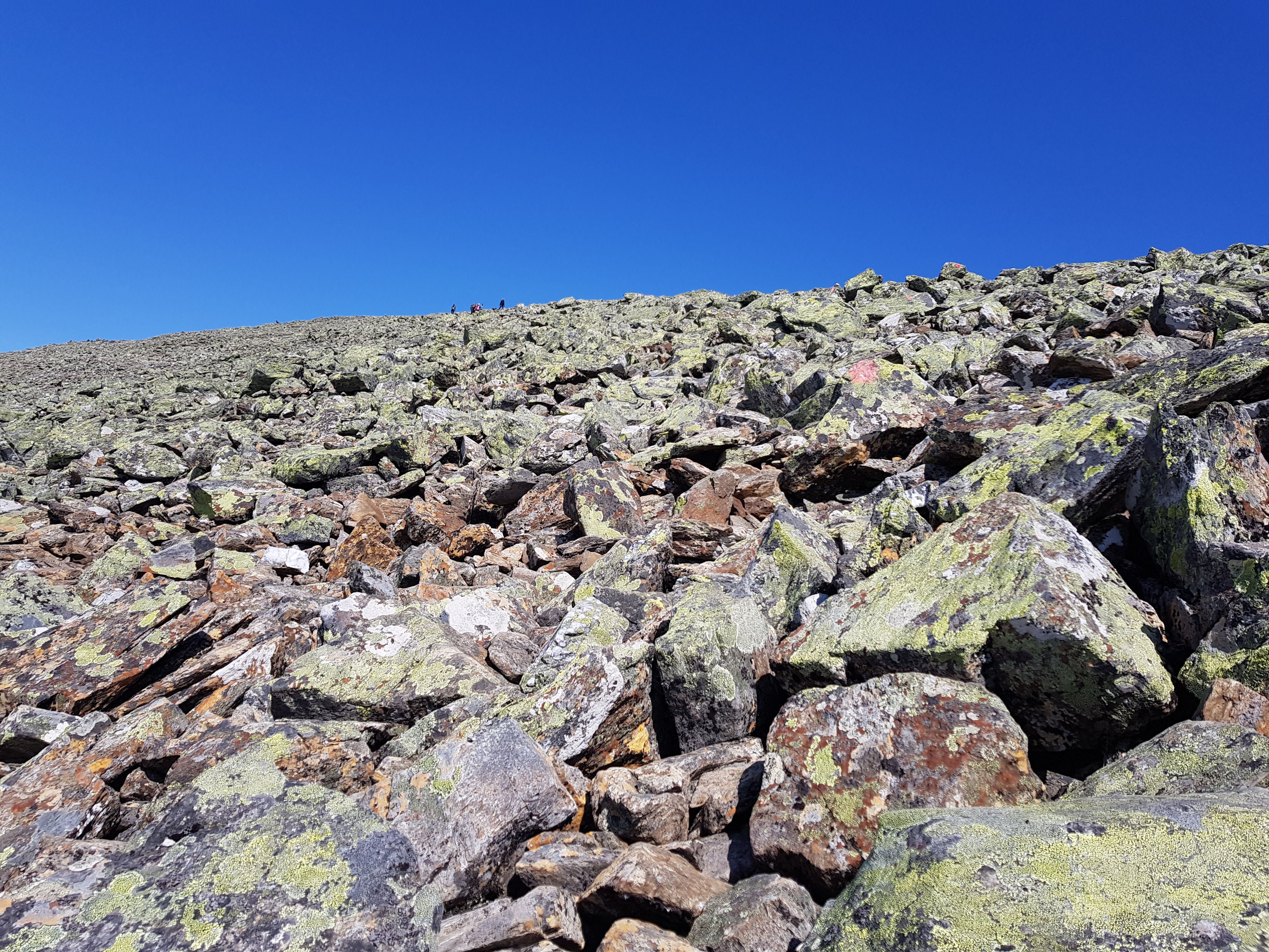
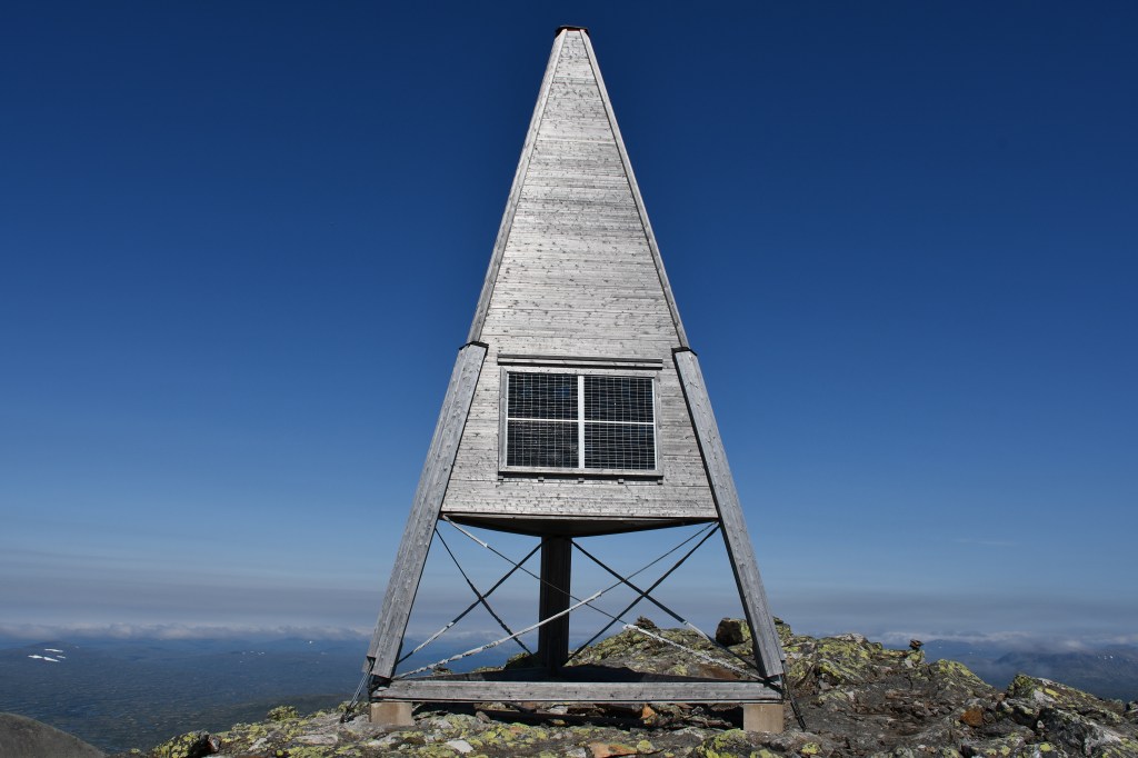
Soon, the trail ended, now, it was time for some balancing act on rocks.
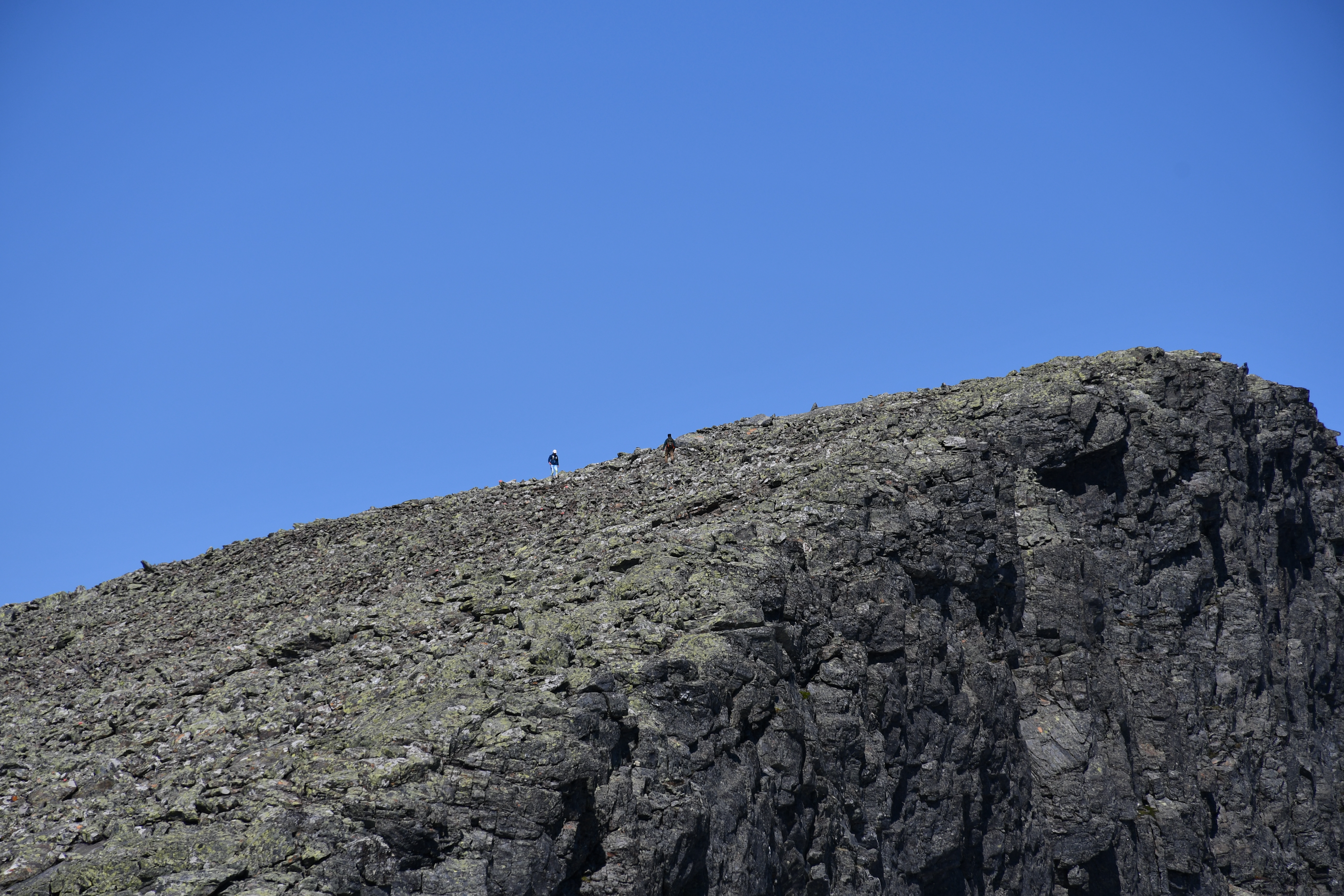
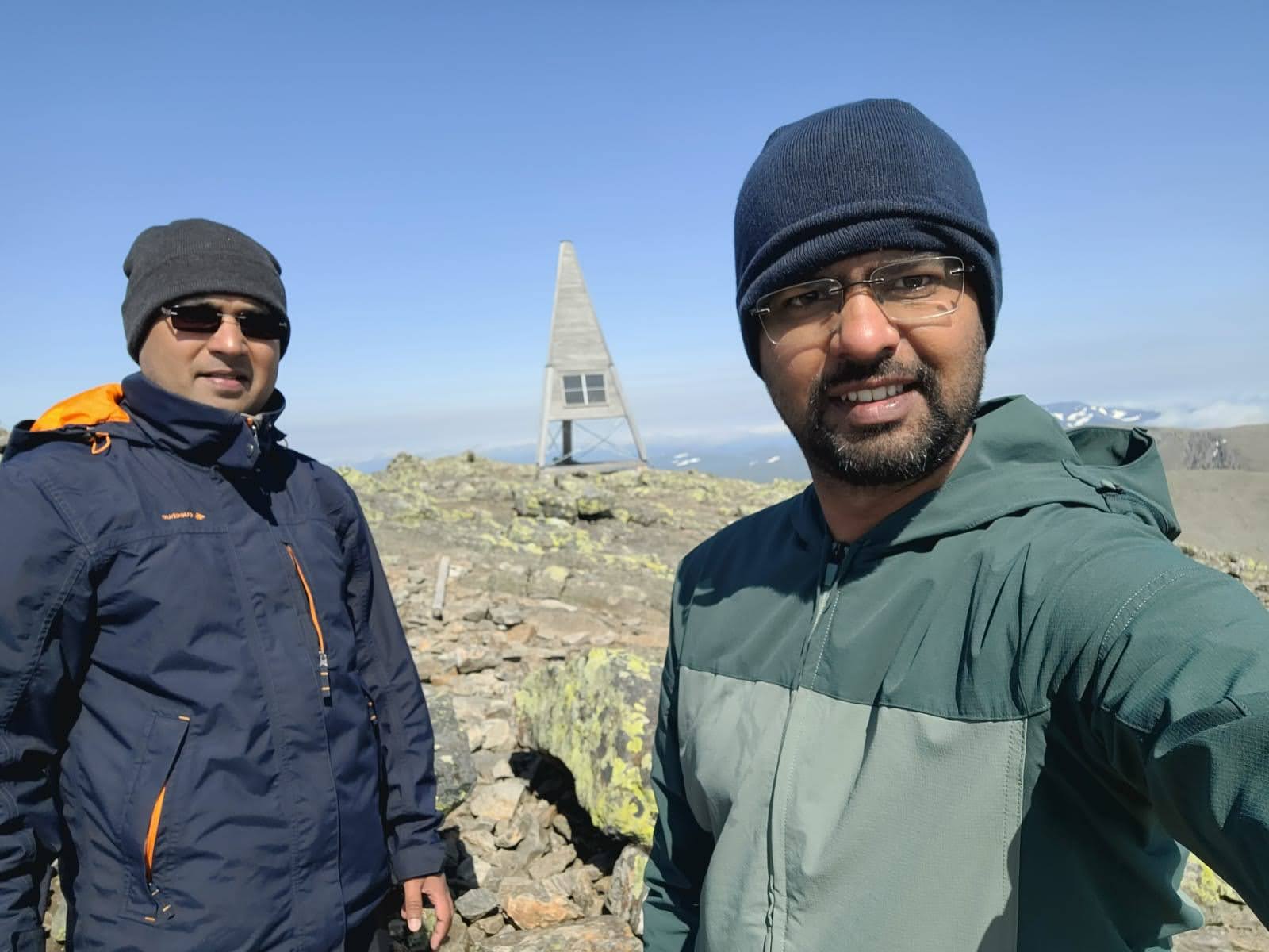
The good thing was the wind had stopped. Surprisingly, I climbed this patch without any breaks or stops, and made it to the summit. Up there, it was so windy that we had to talk loudly to be even audible. DJ had lost his water bottle, borrowed some water from a trekker, and was anxiously awaiting the descent. There were some pro guys who were practically running up and down the summit, with their selfie sticks – I was dumbstruck, also embarrassed 😛
I just took some photos in haste, as it was getting late, and DJ was hasting!!
The mountain of Sylan was visible(NE) from here
Some more pictures from the summit:
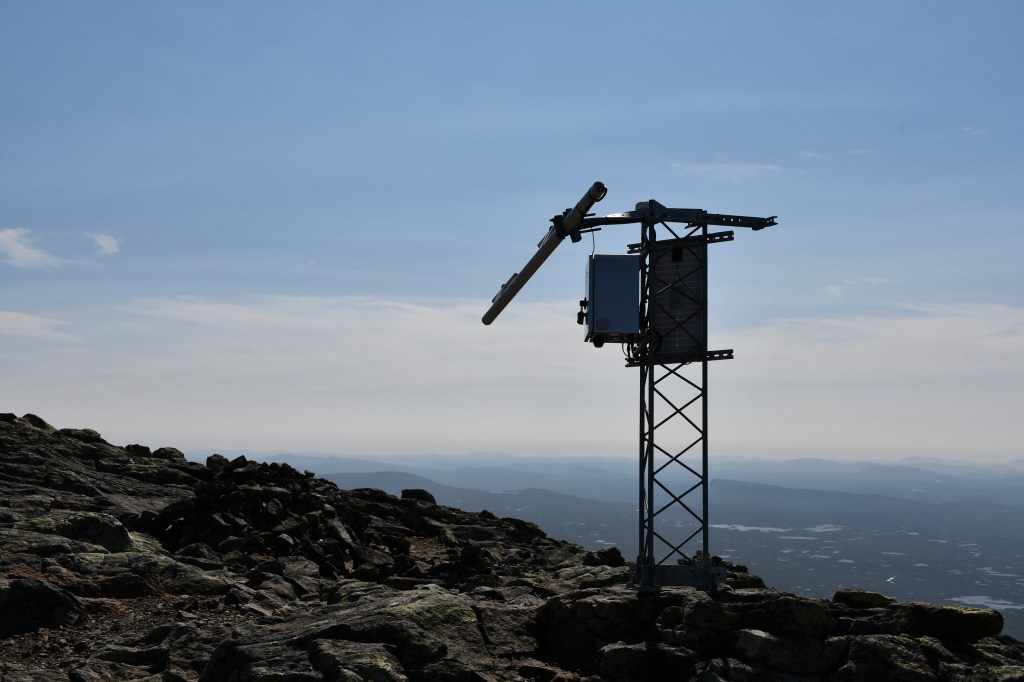

The ascent from the base was more than 700 metre.
We started the descent around 1330 hours. As usual, DJ raced ahead while I took baby steps. DJ would cook a sweet snack for us, and wait for me to arrive. I stopped to take some more photos, chat with the runners(yes, people were practically leaping on those rocks!), and appreciate the surroundings which I couldn’t during the ascent. The pain that the hard sole of the shoe was giving for past two days had now become unbearable. I limped my way down. I met at least 100 persons who were headed for the summit. I also met the duo with their infant. As expected, they had abandoned the plan to reach the summit but were happy relaxing by the glacial stream, and appreciating the sunlight. The boy was interested only in the meal that his mother was unpacking.
By the time I reached the hostel, it was 1530. I freshened up a bit, gulped down the ‘sheera’ that DJ had prepared, and I laid my back on a seat in the kitchen. DJ dozed off again. I couldn’t sleep because of the sore hoofs, I just lay idle.
We hit the road again at 1630 hours. DJ soon disappeared from my sight, and I continued to walk like an old lama. Hikers, 99% of them were families, were flocking to towards the hostel. I finally came across several kids(aged 8 – 14) riding their terrain bikes, and accompanied by their parents. I chatted with a couple who were riding on their respective bikes, along with their 8-year old son. I asked the father whether the kid is tired. He exclaimed “We have been going for 5 hours, and he is not a bit tired. He is rather enjoying it”. The mother, a bit sarcastically, added “He normally complains even for a 1km walk but today, he is enjoying it”. Some fitness freak ‘locals'(probably, staying in Kläppen) were running to and fro on the trail. The winds had fallen, so there wasn’t any hindrance. My speed was around 4km per hour, so I hoped to reach by 1845. By the time the woods showed up again, my toes and hoofs were giving up. I tried to rest my butt in the woods but hundreds of mosquitoes swarmed, and started to bite. I dragged my feet out of the woods. I reached Kesusjön around 1845. I decided to rest a bit. I ate the last energy bar, and watched the calm waters of the lake. That is when I received a call from DJ saying that he had reached the parking.

I was already apprehensive about the last patch – it was pure gravel road, and my feet would hurt even more. I staggered and dragged myself for the last 1.5km or so, and made it before 1930. The parking was not only full, people were arriving!!!
We were resolute about not eating pizza again! We called up the Tuvans restaurang. A guy named Åke received the phone, and welcomed us. The restaurant had spacious outdoor and indoor seating. To our pleasant surprise, the hostel’s caretaker, Eva, was having dinner/coffee with her local friends. They formally appreciated our completion of the hike. Since it was getting a bit cold, we preferred to sit indoors. I ordered Fish ‘n’ Chips, and DJ ordered ‘Moose burger’ and a beer. Enduring pain, we chatted, and gulped the food. DJ was so impressed by the taste that he called up Åke and appreciated it. The middle-aged gentleman was delighted 🙂 . He turned to me and said that Fish ‘n’ Chips are a British thing. I notified him that I am pescatarian, and I was happy with the Fish ‘n’ Chips. When he learned that DJ was keen on tasting the local food, he said that the restaurant would serve Moose meatballs on the next day’s lunch menu. DJ promised to visit.
It was 2030 by the time we reached the hostel. We had a sauna, followed by shower. By the time we retired to our room, we had made up our mind to go back home the next day itself, even though we had booking till Sunday 1000 hours. I was going to start working from Monday, and DJ already had two weeks of outing. We wanted to stay home at least for a day before our respective schedules resumed.
Distance: 20km(walking) + 7km(driving)
Day-5
July 24, 2021(Saturday)
Objective(s): Reach home!
We woke up a bit late, around 0730 hours. After lazing, we had breakfast around 0930 hours, and started to pack our bags. Our movements were like septuagenarians – thighs, knees, toes were aching, and we couldn’t walk normally or regularly. As promised to Åke, DJ headed to restaurant around 1100 hours. I had my breakfast around 1000, thereby, I decided to have a late lunch.
DJ was back in less than an hour. To my pleasant surprise(and embarrassment), Åke had cooked some Salmon since I was a pescatarian. He was disappointed to not find me, I hope DJ explained my side fairly 😦 . He packed the Salmon, and sent it via DJ. Even though I wasn’t hungry, I gulped it.
We cleaned our room, and notified Eva about our early departure. She invited us to stay again, perhaps with our families. She informed us about the half and full summer (ski roller)marathons taking place during the day where adults, teenagers, and kids would be participating. Some roads were closed for traffic, and she warned us to drive cautiously. We started to load our bags. We commenced our return journey around 1230 hours.
My lunch was pending, and we didn’t want to spend much time finding a good restaurant. En route, we stopped at Kårböle Resturang (around 1500 hours). It was a spacious restaurant, the taste was average. Even while climbing one floor up, we struggled and moaned a bit which surprised our fellow guests 😛 . I took my time, and it was 1600 hours by the time we hit the road again. Home was still 400+ km. As per our original pact, I would hold the wheel till we hit the E4.Sitting for long in the car was hurting our back and limbs, we decided to take another break. We stopped at OKQ8 near Rastplats Tönnebro at around 1800 hours. While the coffee was awful, I recommend this place for a break, especially if you have kids. There is a small beach with a play area.
We hit the road again around 1830. Hereafter, it was E4 all the way(around 250km) till home. I offered to drive another 50km or so but we had two problems – stopping on highway to switch places was infeasible, also, I was tired since I had been driving for almost 400km now. DJ took the wheel. We reached home around 2100 hours.
Distance: 620km+(driving)
Epilogue
Personally, I found Swedes staying in the remote areas much more warm and welcoming than the ones I have met so far(in the Stockholm county). Maybe, I am wrong here but as of now, I am convinced that the rural Sweden is probably more welcoming that the metros.
Many of my Swedish colleagues congratulated me for spotting an Artic Fox family – it is rare even to spot a single one in Sweden. I got a chance to view the pristine wilderness.
The hiking involved walking more than 55km in 3 days, my personal record 🙂 . While my fitness raised many alarms, I was quite impressed and motivated by the fitness levels of DJ, and the other hikers I met. Being a new driver, the trip boosted my confidence of driving and hiking within a span for few days.
- Scandinavian weather can change daily, hourly, hence, carry clothes accordingly. Irrespective of the month of the year, at least a windproof, rain jacket is indispensable.
- Lodging in Sweden is generally expensive, and in the North, the prices go further north. Commit to the summer trip at the beginning of the year, and proceed right away with the reserving places to stay. The other stages of planning can be deferred.
- The more you understand the geography, the better you can plan, pack, and execute.
- As far as hiking and trekking is concerned, fitness is must, lest it is more labour, less pleasure.
- Carry your own medical kit. Getting medicines in remote parts of Sweden can be tricky.
- Keep 1 day as a buffer for every 2-3 days of trip. Weather, health, vehicle – anything might go wrong!
- For pristine/prime POIs, reserve ample time so that you can freeze the experience in your memory.

very well written
Could actually feel the thrills of the trek.
Made me watch some videos on getting fit for hiking 😁
LikeLike
very well written
Could actually feel the thrills of the trek.
Made me watch some videos on getting fit for hiking 😁
LikeLiked by 1 person