- The readers can skip this section and the Prelude, in case they are interested only in the itinerary.
- To share as much information as possible, I provide hyperlinks to the Point of Interest(POIs), important events, geographical features and so on. I recommend readers to spot, and follow those hyperlinks.
- To avoid cluttering the post with details of every POI, I do NOT write the detailed reviews of the same.
- Some information might be left out unintentionally or out of time constraints. Feel free to contact me in case you need any relevant details.
- I try to post as many distinct pictures/photos as possible, to give a fair idea of the entities, but the objective is not to provide a photo album. Google Maps or, in general, on the Internet, aplenty pictures are available for the viewers.
- Prelude
- Galdhøpiggen: Overview of Routes.
- Itinerary
- Day-1: Driving from Sweden to Norway.
- Day-2: Relaxation in Otta and Lom.
- Day-3: Attempt to summit Galdhøpiggen.
- Part-1: Commencing from Spiterstulen
- Part-2: Trails and gradient commence !
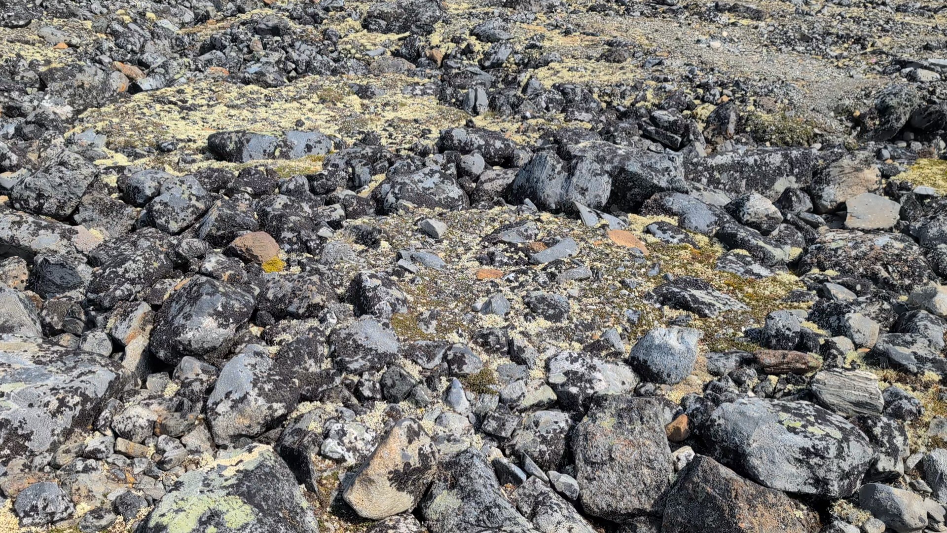
- Part-3: First patches of snow, first plateau.
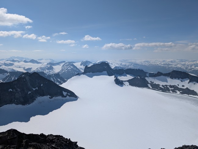
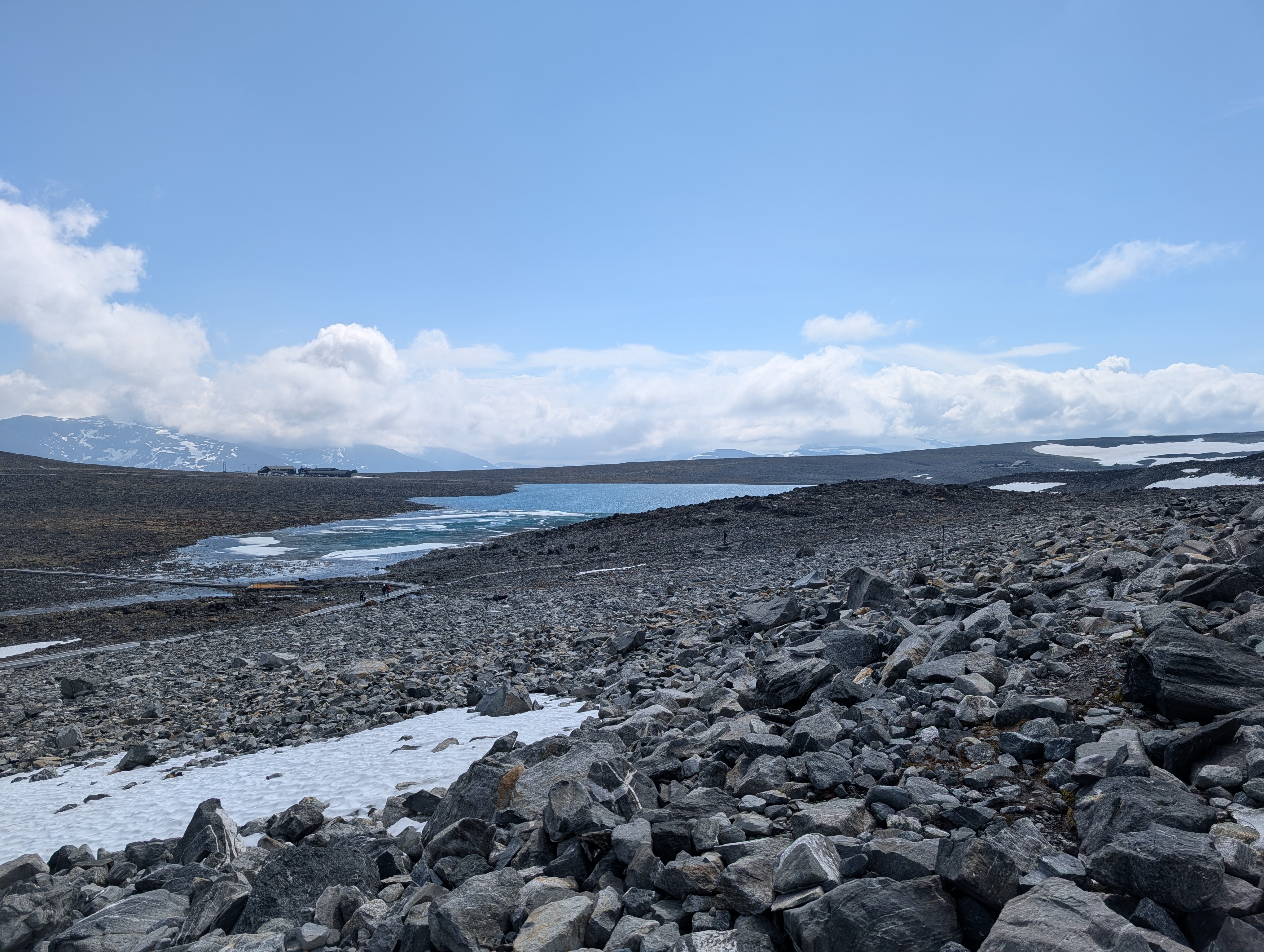
- Part-4: The Styggebreen glacier is visible, Svellnose is still far away !
- Part-5: Svellnose partially bypassed, Keilhaus topp and Galdhøppigen summits visible.
- Part-6: Keilhaus topp surpassed, Galdhøppigen in sight.
- Part-7: Finally, reached the summit !!!
- Part-8: Hasty fallback from the summit.
- Stats
- Crash course for the impatient(skip all above steps)
- EOD.
- Day-4: Visit to Klimapark 2469
- Day-5: Stay extension, and consecutive disappointments !
- Day-6: Home Run
- Epilogue
Prelude
I had not undertaken a single, day-long hike since July 2022. My fitness had/has declined enormously, thereby, I had lost confidence in undertaking tall/high summits.
I had no intentions to undertake a hike but the weather was pleasant, and motivating. I had delivered most of my part in our current project at work. My family was abroad for a vacation. I impulsively decided to undertake a hike, and it was impossible to inform, and gather partners for the trip. I decided to go solo. I glanced at my list, and with aplenty apprehension, zeroed-in on Galdhøpiggen. It is the highest mountain in Norway, Scandinavia, and Northern Europe.
Galdhøpiggen: Overview of Routes.
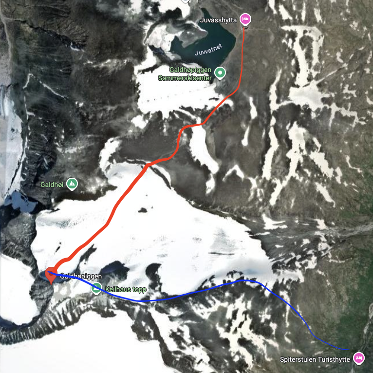
The summit of Galdhøpiggen can be reached via two routes:
| via Juvasshytta(marked in red in the above image) | via Spiterstulen Turisthytte(marked in blue in the above image) | |
| Height of the base from sea level(approx.). | 1800 metres. | 1100 metres. |
| Elevation gain till summit(approx.). | 640 metres | 1380 metres. |
| Route details. | 1. Needs glacier crossing. 2. Less gradients. 3. Slower but easier. 4. Only one summit(Galdhøpiggen). | 1. Marked trail. 2. Frequent gradients. 3. Faster(if fit) but much harder. 4. Three summits: Svellnose, Keilhaus topp, and Galdhøpiggen. |
| Walking distance(approx.). | 5.5 km | 6 km |
| Time(approx.). | 5-7 hours. 3-4 hours up and 2-3 hours back. | 8-10 hours. 5-6 hours up and 3-4 hours down. |
| Noteworthy details. | 1. While not mandatory, a guide is required to cross the glacier. 2. Guided tour can be booked online. 3. If one cannot keep up with the pace of the group, the person is ‘left behind’ – he/she must detach from the group, and either wait(if left behind after the glacier) till the group returns or fall back(if left behind before crossing the glacier). 4. Gear is provided by the operators. 5. The tour is subject to the weather conditions, and generally follows strict timelines. 6. No shelters or anything en route, except the small hut at the summit. | 1. Marked trail, can be done without any guides/guidance. 2. Unsure if guided tours operate on this route. I didn’t meet any ! 3. Self-paced, one can practically walk easily as long as the daylight is available. 4. No special gear needed, however, a good pair of walking sticks, and shoes with ankle-support, and good grip are recommended. 5. If weather turns hostile, one is on his/her own ! There would be fellow hikers but that depends on the season ! 6. No shelters or anything en route, except the small hut at the summit. |
Itinerary
My plan was ambitious:
- Day-1: Drive from Södertälje to somewhere near Galdhøpiggen.
- Day-2: Rest, and a mini-tour on my bicycle.
- Day-3: Hike to Galdhøpiggen.
- Day-4: Buffer, in case the weather is unsuitable on Day-3.
- Day-5: Drive back to Södertälje.
As I dived into the details, and checked the weather forecast, I decided to attempt the hike on a Sunday. Saturday would have been better but it was unsuitable for my leave plan to start from Södertälje on Thursday.
Day-1: Driving from Sweden to Norway.
July 11, 2025(Friday)
I wanted to stay at the Spiterstulen Turisthytte but they don’t have a kitchen i.e. one cannot cook one’s own food but have to buy/order all meals from them. This is a disappointment for a pescatarian like me. I normally prefer to stay at hostels for cheaper prices. Yet, given the upcoming drudgery, weather forecast, and my own poor fitness, I hastily booked a cottage in Lom.
I had loaded most of my luggage in the car on the previous(Thursday) night. I simply attached my bicycle stand, and loaded my bicycle on it. I started from Södertälje around 0800. The drive from Södertälje to Lom was around 750km(9h as per Google Maps), and I wanted to cover it in a single day.
My first stop was for lunch at Karlstad around 1100(approx. 275 km). I started to drive again within 30 min. Next stop was Charlottenberg where I reached around 1300(approx. 110 km). It is the last Swedish town on the Highway 61(riksväg 61) before the Norwegian border. I wanted to fill up before entering Norway. I never bought/used ice grippers, and was unable to find a pair in and around Södertälje during summer time. I hastily bought one at a shop in Charlottenberg. Note that Norwegians flock this town for shopping, and Swedes fill up here. This swamps the Circle K station here. I had to wait for 10 min. for my turn. I hit the road around 1400.
The drive from here till almost EOD was excruciating because:
1. The E6, route 24 between Charlottenberg and Otta is mostly a 2+1, and a single road. The speed limit is less than 100(mostly 80-90).
2. Caravans, trucks, and slow drivers cannot be quickly overtaken. I recall that at one point, I had to drive 30km at speed of 60 kmph before it was my turn to overtake a group of such slow vehicles.
I was so exhausted by the time I reached Otta that I decided to take a break here(1830, approx. 690 km). The Circle K here was surprisingly large, clean, and had aplenty food options. There store is also well-equipped with frequently needed items. I ate a mini-pizza, a nasty way to beat the frustration of driving.
I started around 1915 from Otta, and drove to the camping site(approximately 60 km). I reached there at dot 1955, meaning it was a 12-hour drive instead of the expected 10-hour. Thankfully, the reception was open till 2300. Even after such a long drive and one more shower for the day, I couldn’t sleep till 0100, a pattern that would follow all the way till I return home.
Approx distance driven : 750 km
Day-2: Relaxation in Otta and Lom.
July 12, 2025(Saturday)
I woke up around 0730, and was ready by 0900. My plan was simple:
1. A leisurely, mini ride on bicycle on a scenic route.
2. Visiting the tourist information centre in Lom to gather some information about the upcoming hike, and a visit to Klimapark 2469.
3. Take a stroll in the town if time permits.
4. Sleep early so that I can wake up at dawn.
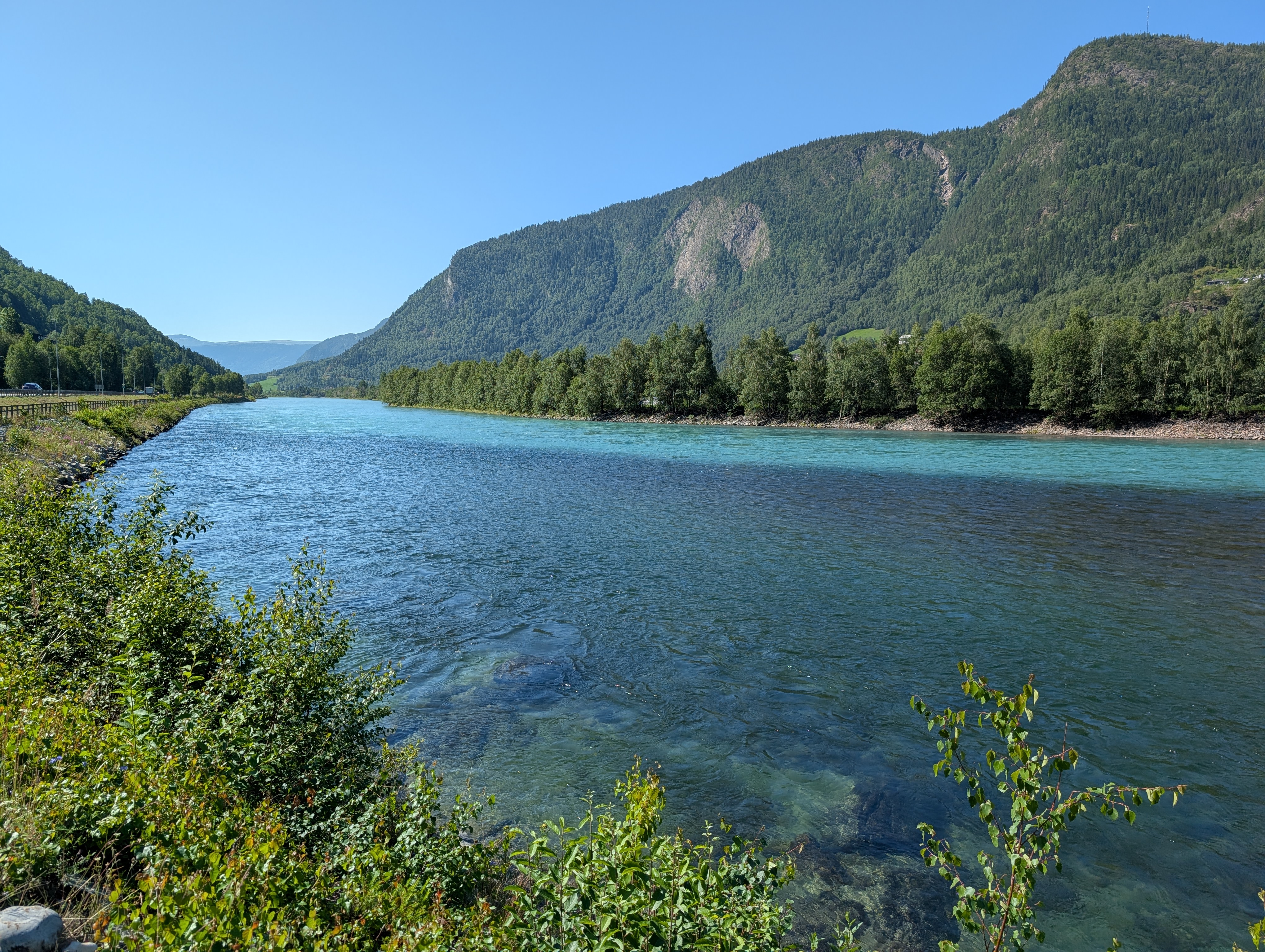
As is the case with each successive Scandinavian summer since 2017, this one was warmer that the previous one. It was 28/29 degree celsius, and sunny. I decided to not go far(my initial plan was to drive 130km one-way to ride on a remote but scenic route) for a ride as I wanted to conserve my energy for the next day. I decided to ride by the Otta river, and just absorb the pleasant and serene views. I reached Otta around 1000.
Tip: It can be tricky to find a parking space in Otta, especially for more than 2h. I parked near Kiwi, and I highly recommend it.


I rode a little more than 15km but it was getting hotter, and I was getting hungrier ! As I didn’t want to again eat outside, I decided to drive back to Lom. I left around 12oo, and was at the cottage by 1250. I took a cold shower, had a leisurely lunch inside the cottage, and left for a stroll around 1430.
One of my main concerns was finding my way back in case it rains, and the mountains are covered by clouds. I was keen on buying a large-scale trail map. Unfortunately, the ones available at the tourist information centre didn’t have a scale that can help in navigation under such situations. I also realized that in a hasty packing, I had forgotten to pack a fleece jacket which would be required in case it gets cold and windy. I quickly bought one at the tourist centre itself. They had good prices for clothes of decent quality.
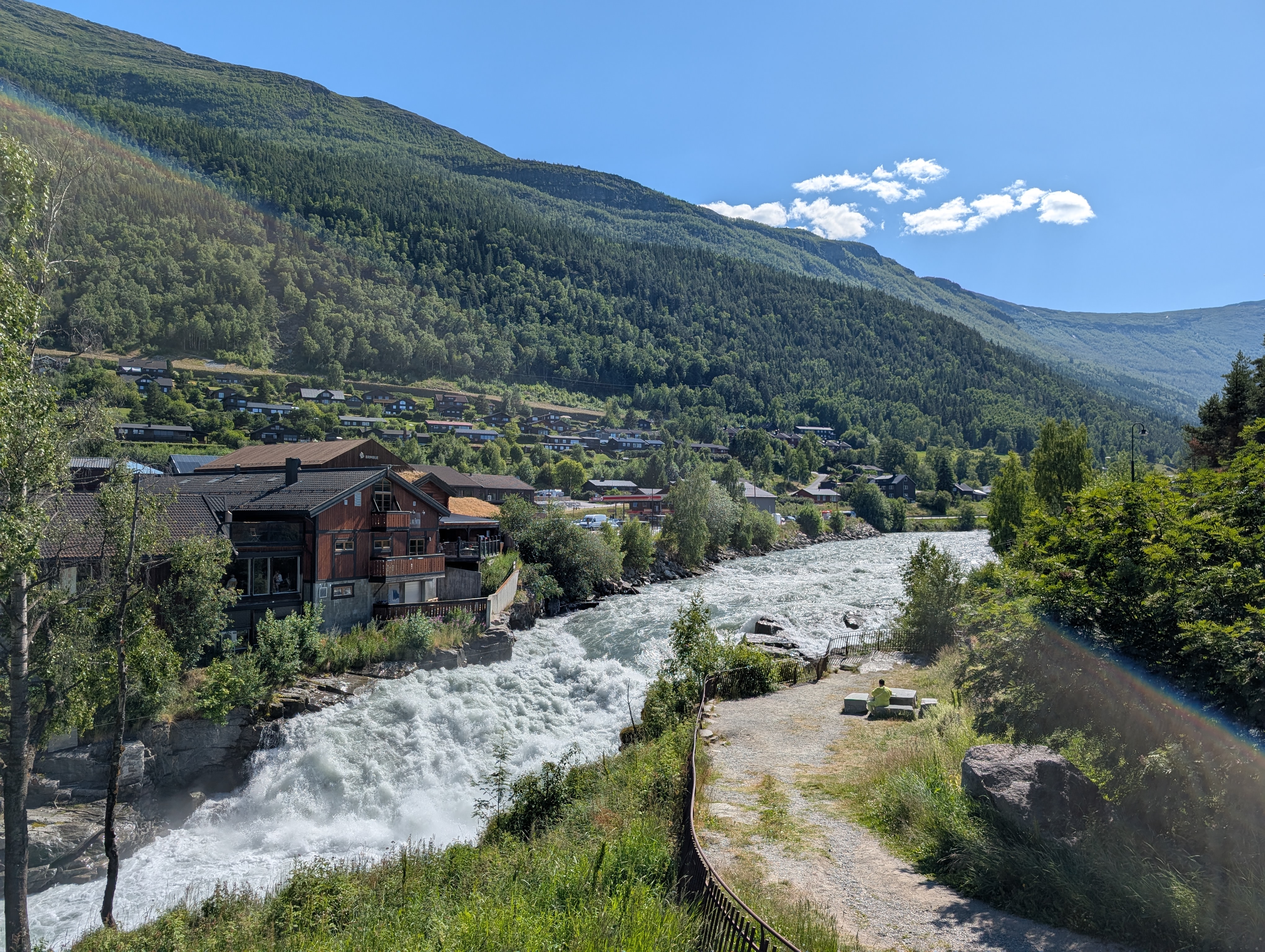
I crossed the street, and entered the Norwegian fjellsenter. I wanted to visit it but it was already 1530, and they were closing at 1600 or so. I was informed at the reception that the tickets for Klimapark 2469 are sold, and rescheduled online ! Just outside the fjellsenter is a pleasant view of the Prestfossen.
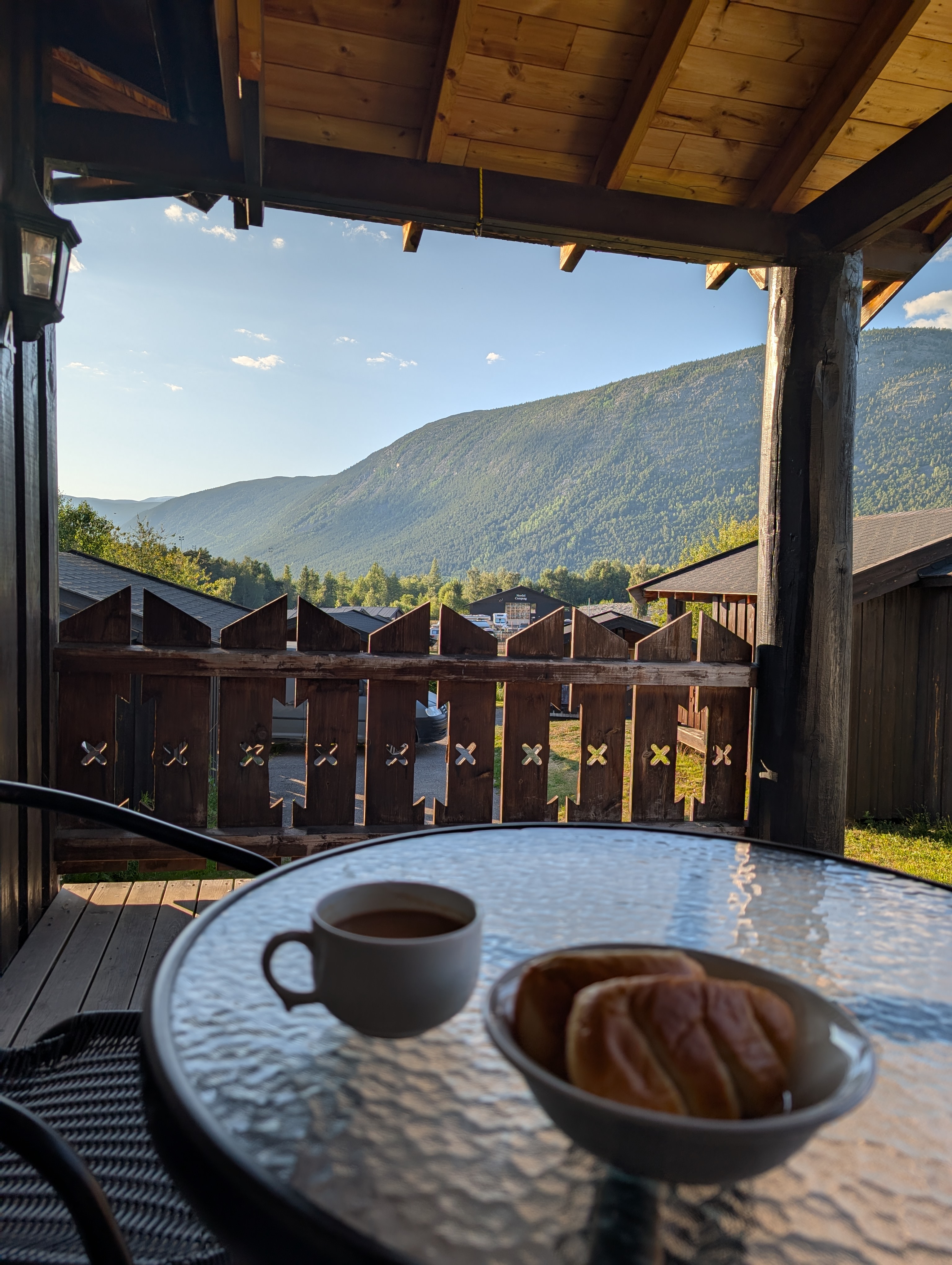
I returned to the cottage around 1700. It was now time for some idling. I prepared a cup of Indian ‘chai’, and spent the evening sipping it while seated on the patio.
I wasn’t hungry owing to a late and heavy lunch. I just had some soup, and started to pack my backpack for the next day. My plan was to wake up as early as possible, drive to the base of Galdhøpiggen(via Spiterstulen), and hike at my own pace, as long as I can !
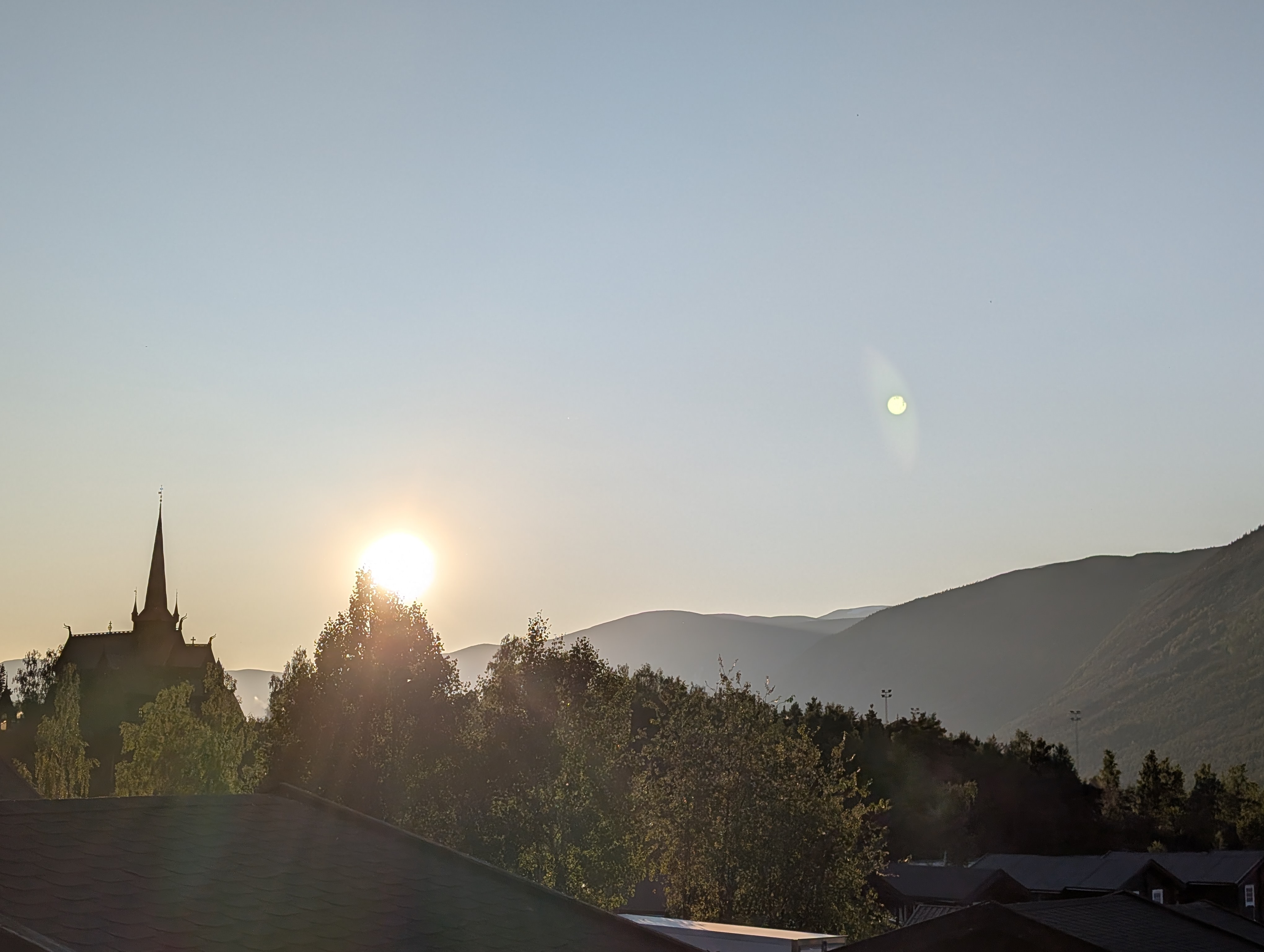
As compared to Södertälje, the daylight here in July was much more. I could see the twilight even at 0030. The pic below was taken at 2100, just before I went to bed:
Approx distance driven : 125 km
Day-3: Attempt to summit Galdhøpiggen.
July 13, 2025(Sunday)
When I zeroed-in on Galdhøpiggen, I had decided to take the Spiterstulen route(see ‘ Galdhøpiggen: Overview of Routes‘). The sole reason was my lack of fitness – I wanted to attempt the summit at my own pace, without any deadlines or constraints!
I woke up at 0400. Washroom, shower, tea took sometime as I couldn’t sleep well. I had cold breakfast. I prepared two double-egg cheese sandwiches for lunch, and packed them in an aluminium foil. Water(4 litre), power-bank, first-aid kit, raincoat, jacket, extra pair of clothes, inners, socks, etc. made the backpack weigh a little above 10kg.
The drive from camping site to Spiterstulen took less than 40 min(34 km). I drove slowly to take some pics, ponder, and enjoy the fresh air in the morning as I was aware that I would be rushed and stressed till EOD.

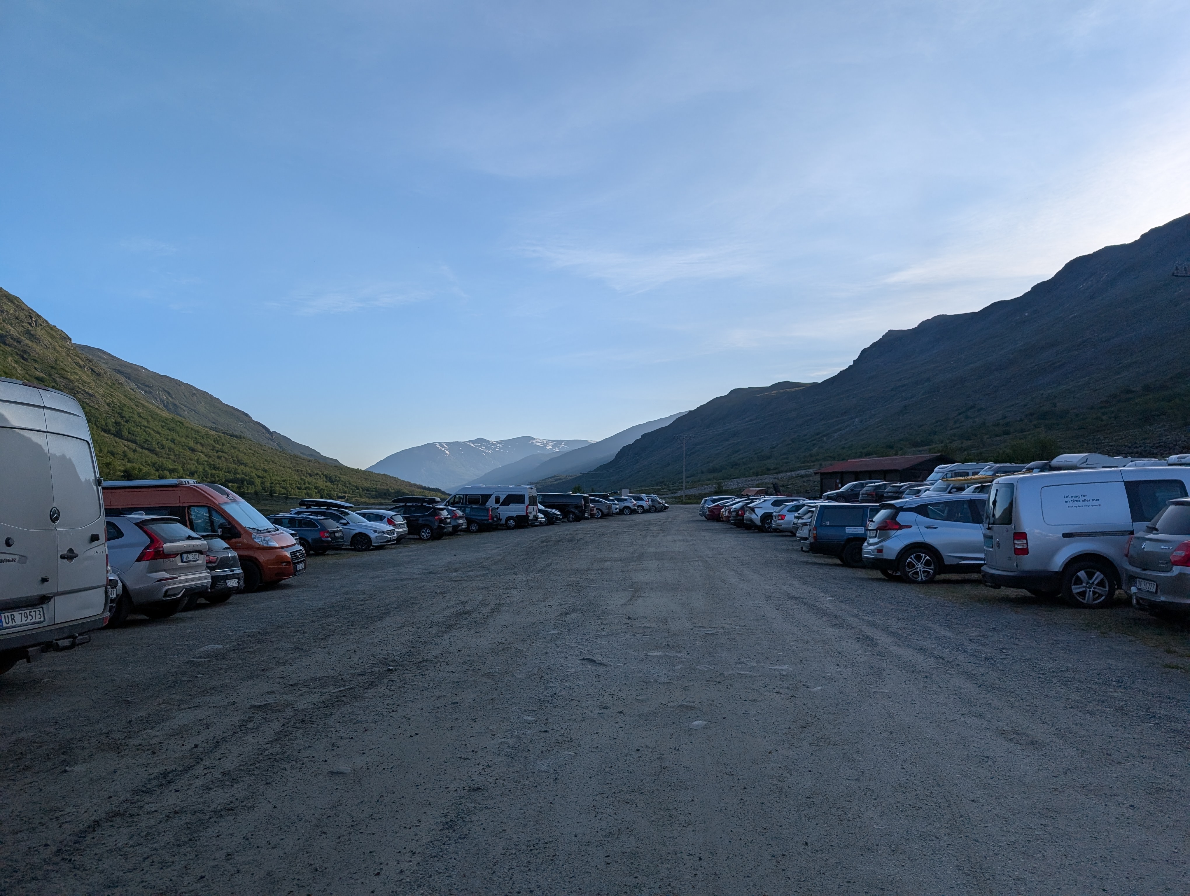
I was in the parking lot around 0700. There were at least a 100 vehicles of various kinds. There were approximately 50 tents by the river.
Tip: The machine present there was not really meant for payment or registration. The registration plate of the car was automatically scanned by cameras on every entry and exit. When the stay is completed, one must then go their site(URL provided at the kiosk) and put the registration no. to get the final bill. This can be paid online but remember to pay it within 48h of your last exit, thereafter, you would get a bill(with perhaps an additional amount) to the address registered for that car.
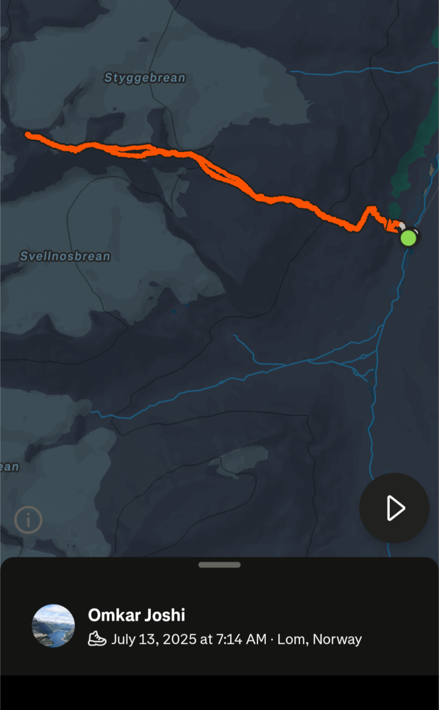
I hit the trail at 0720 hours. I normally take notes, and reproduce them in the text format later but henceforth, I would be primarily using multimedia(video) format. I created step-wise videos, and tried to provide some information in each one of them.
Part-1: Commencing from Spiterstulen
Part-2: Trails and gradient commence !
Part-3: First patches of snow, first plateau.
Part-4: The Styggebreen glacier is visible, Svellnose is still far away !
Part-5: Svellnose partially bypassed, Keilhaus topp and Galdhøppigen summits visible.
Part-6: Keilhaus topp surpassed, Galdhøppigen in sight.
Part-7: Finally, reached the summit !!!
Part-8: Hasty fallback from the summit.
The joy of summit, and the expectation of absorbing the experience didn’t last longer. I was delayed by at least 2h, but the worrisome parts were:
- It was getting cold, winds were getting strong. This smelled of trouble !
- As most of the hikers had already left/were leaving, I was a bit worried about falling behind, all alone!
- As mentioned earlier, there are no shelters or huts on the entire trail!
Considering all the above factors, I waited there less than 20 minutes. I was already exhausted, and my phone battery had drained. I connected it to the power bank, and put my phone inside my backpack. I decided to NOT invest any time in more videos and photos(later, this proved to be an exceptionally lucky decision). I started my descent around 1600.
The snow patches, especially the Keilhaus ascent were exhausting to climb but posed even a larger problem while descending – the stress on the knees, and chances of falling and hurting self ! I took a desperate decision – I simply sat down, and slid all the way. My butt, inners got drenched but I descended this entire patch in less than a minute!!! I was relieved, and felt confident, thereafter, I slid on each large snow patch, thus, speeding the descent.

I reached the plateau(check the first part of the videos) in less than 2h(around 1800) but then rains and wind hit so hard that I had to take cover against a large rock. I was having company of a Norwegian gentleman, and a Polish family with two kids. We waited almost for 45 minutes for rains to slow down. The visibility was poor, and even overweight guys like me were getting swayed by the wind. The only relief was that Spiterstulen was in sight, even though 1.5h far. The most tricky and steep summit descents were left behind. I was glad that I left hastily as soon as the winds turned cold and strong.

We resumed our descent around 1900 but it was pretty slow due to strong streams gushing downwards, and the trail was covered with mud and water. The Norwegian gentleman kept company, and we soon discovered that we both were/are interested in technologies used/evolved during WW-II. We chatted a lot, and it made the descent tolerable – the rain jacket saved my upper body, the backpack was dry as I had carried its rain cover but everything below waist was a pond !
We reached the parking at 2010. It was almost 13h since I started walking from the parking. I took 5h extra(minus 1 for the stop due to the rains) than the expected 8h. I bid goodbye to the gentleman, and changed my clothes in the parking. People were sitting outside their tents, and relaxing while I was desperate to hit the shower in the cottage.
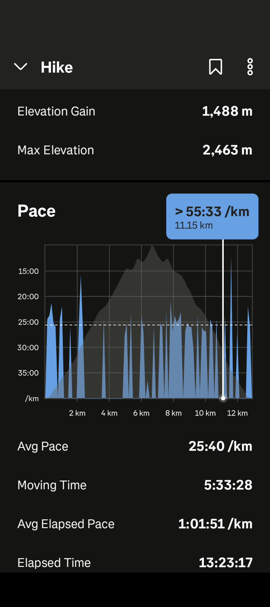
Stats
Crash course for the impatient(skip all above steps)
The impatient ones can simply watch this single video in case they wish to skip the step-wise information.
EOD.
I reached the cottage around 2130. I had a hot shower, a leisurely dinner. I was angry with myself for neglecting my health but the satisfaction of completing the hike subdued the anger. I had already booked a guided tour of Klimapark in English which was scheduled at 1000 for the next day.
Light rains were coming down sporadically. My wet clothes were hanging in the shower, longing for the sun. I couldn’t sleep in spite having woken up at 0400, and a 13-h hike. I finally fell asleep sometime after 0030.
Day-4: Visit to Klimapark 2469
July 14, 2025(Monday)
I woke up at 0730. The first thing I did was to hang my wet clothes on my bicycle stand, and placed my wet shoes in the sun. Thankfully, I had packed an extra pair of shoes for such situations, and I was good to go for the guided tour. I got ready, had breakfast, and was ready to leave by 0900. My knees and thighs were a bit sore but nothing unbearable. I forgot to pack/buy sunscreen, and didn’t feel/realize any damages during the past evening shower but in the morning, I felt a burning sensation on my face below the nose, including cheeks. I realized that I had got sunburns, and now the skin was sore. It took almost a week for it to heal!
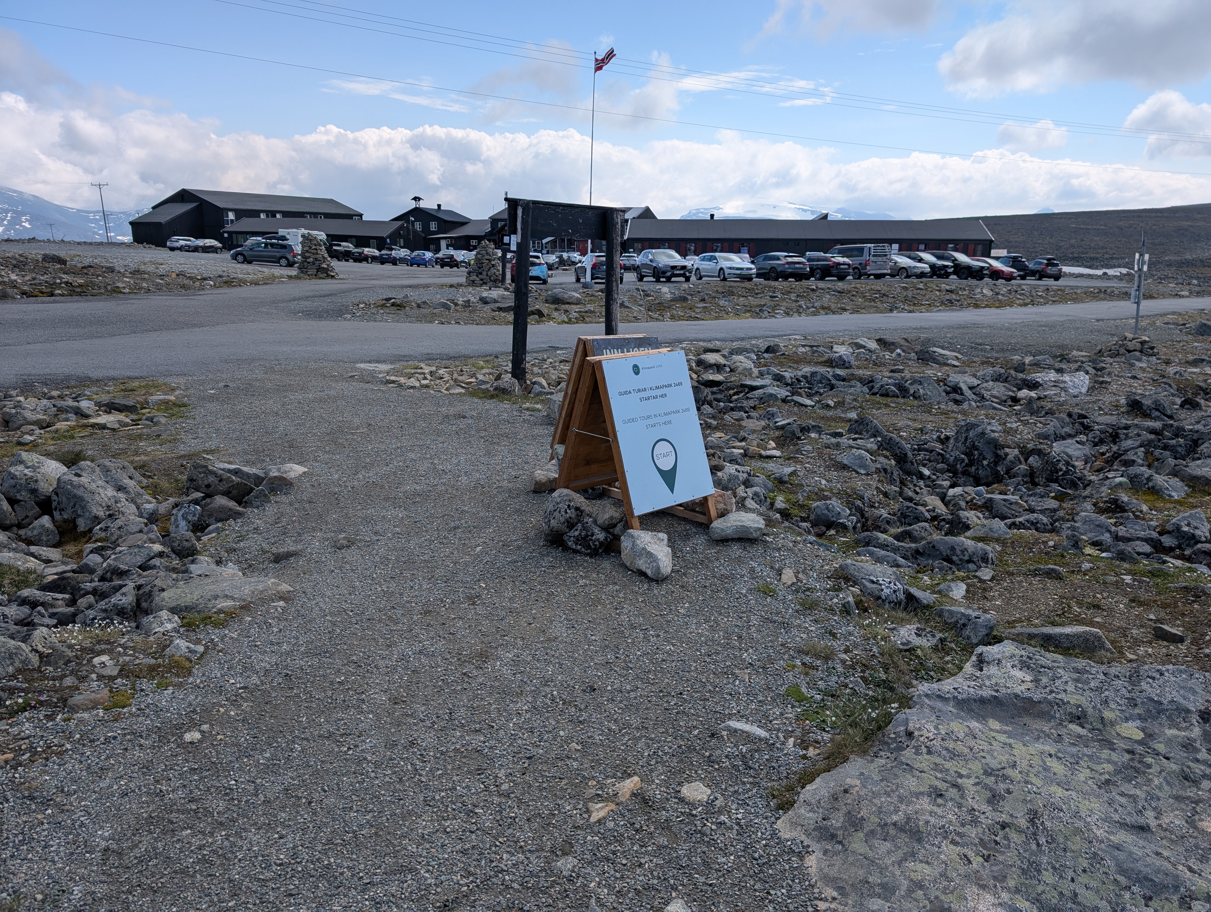
I reached the Juvasshytta parking around 0950, after ascending a bit scary serpentine road. It had no side/safety barriers on the sides where the vehicle was exposed to the cliffs.
The tour started at sharp 1000, and was planned for 2h. There were around 25 participants.
Our guide, Kathnika(I hope I got her name right!) was enthusiastic. The best part about the tour was the inclusion of small, practical demoes rather than mere talking. We walked over a steel-enforced path, sometimes stepping out on the adjoining ground. I was pretty happy as I gained basic information about geology, botany, and climate change.
Climate Monitoring
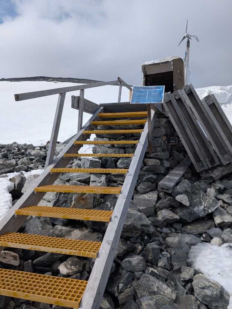
Klimapark 2469 collaborates with leading research institutions on climate and environmental change in the high mountain area. This work is part of the Fjellviten project, running hem 2024-2027. There has been a weather and permafrost station at Juvasshøe since 1999. This is used for both weather forecasting and climate research, and at 1894 metres above sea level, it is Norway’s highest official station of its kind.
- Juvflye has permafrost, and there are several boreholes in the area where changes in the ground temperature are measured.
- Vegetation monitoring is being conducted at the Juvflye to investigate the consequences of rising temperatures.
- Dating of organic layers (plant remains) in the ice tunnel in Juvfonne has been carried out to determine the age of the ice.
- Measurements of ice and snow at Juvfonne and other ice patches and glaciers in Jotunheimen are conducted annually.
- Sediment sampling is being carried out of the bottom of Juvvatnet.
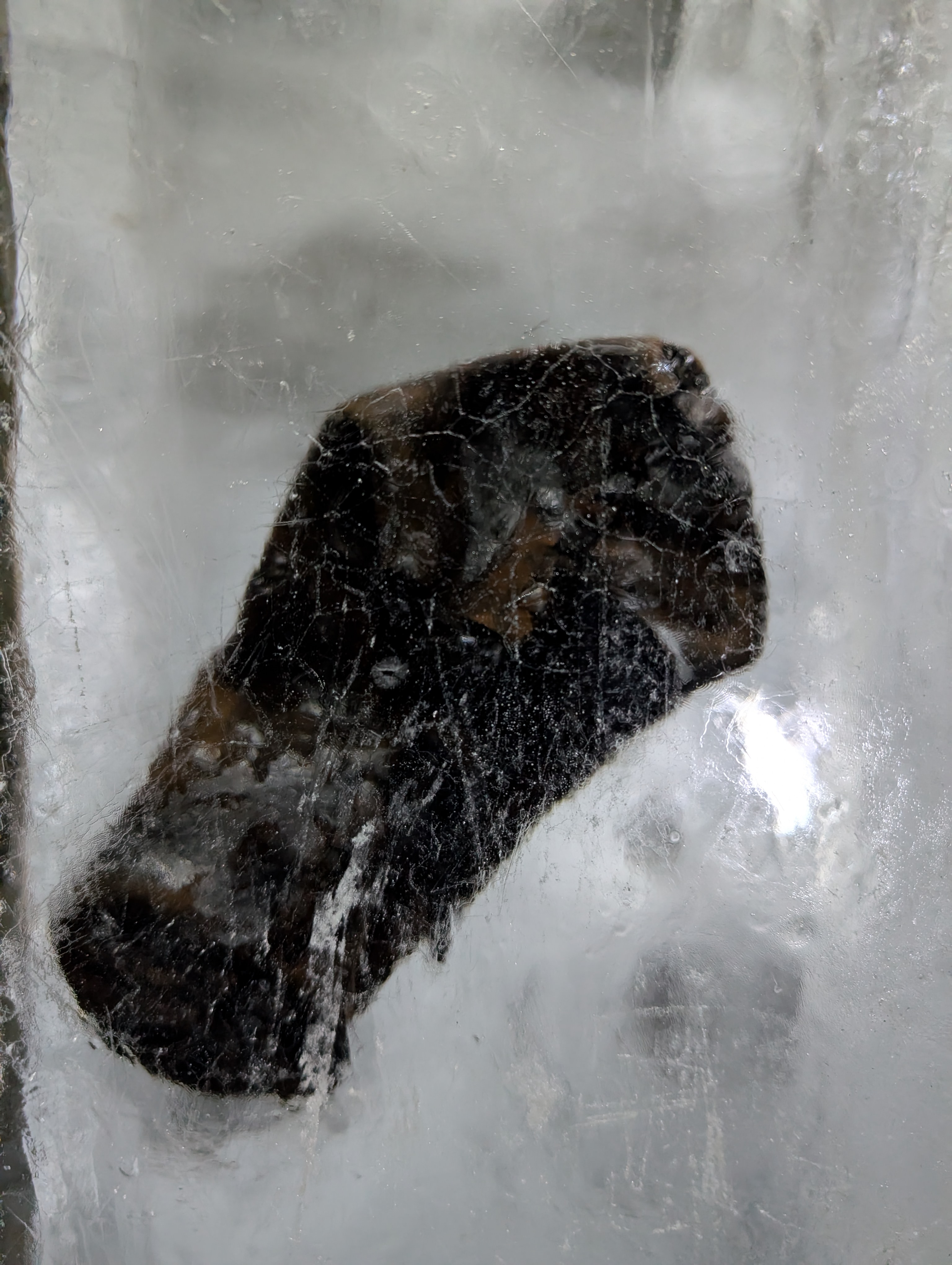
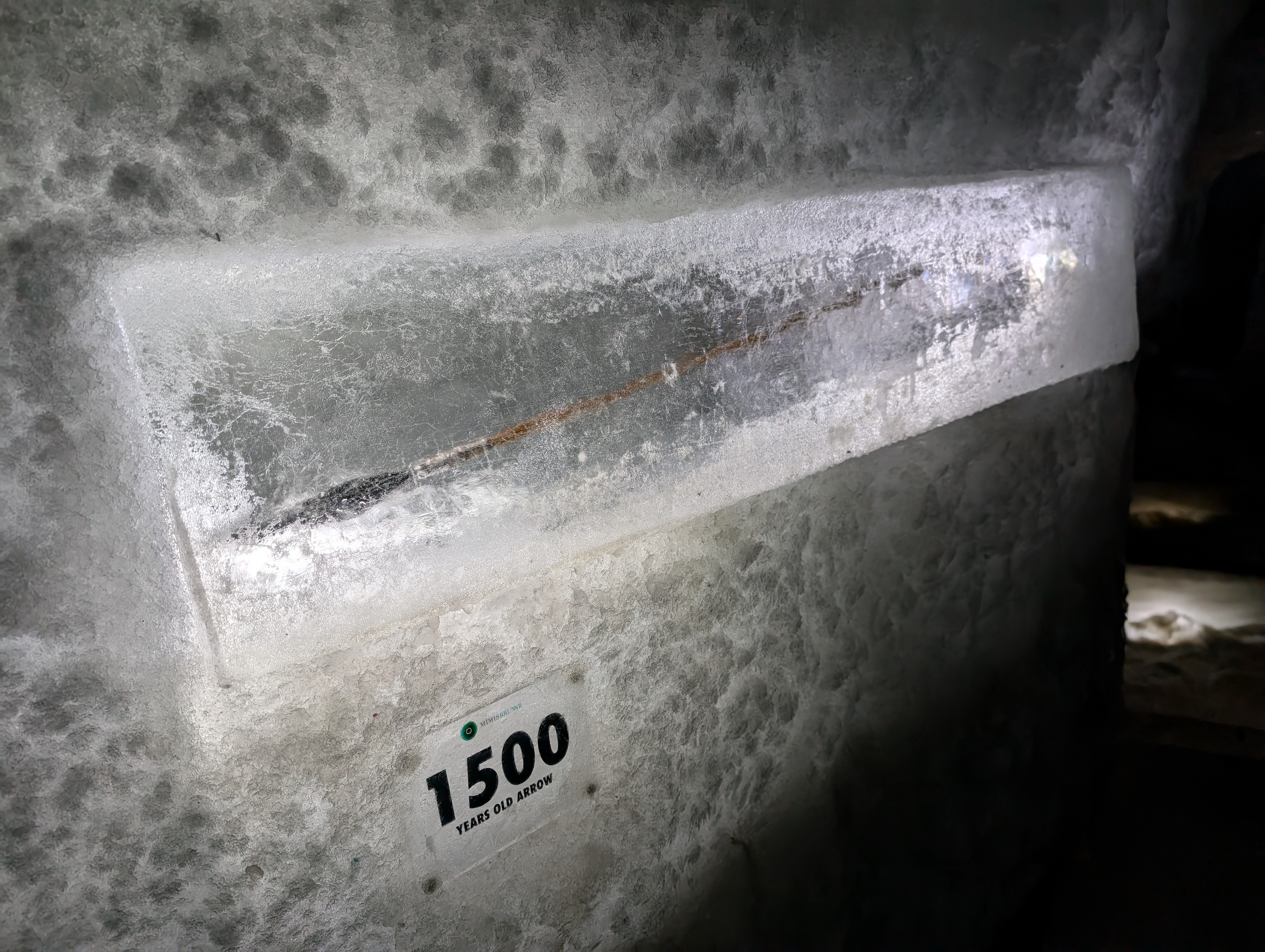
- Every year, archaeologists discover objects emerging from the melting ice at Juvfonne.
Combined, these measurements provide a pointer as to how nature responds.
Juvfonne: A ‘permanent ‘ ice patch.
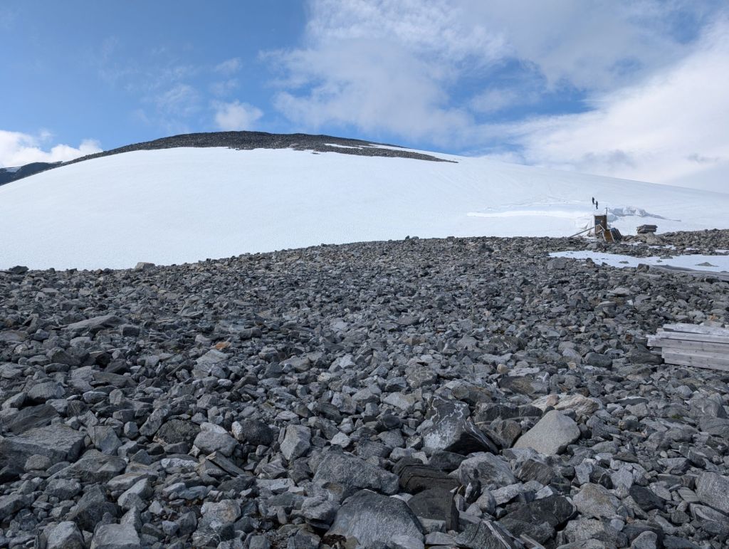
Juvfonne is one of the many hundred ice patches in Jotunheimen that do not melt completely during summer. The size of the ice patches can vary greatly from year to year. Following a warm summer, there will still be ice patches left in late autumn. The ice at the bottom of these can be very old. Ice patches differ from the glaciers by having a lower ice temperature. Glaciers in Jotunheimen are temperate, i.e. the ice temperature is around 0 degrees and water can penetrate down to the foot of the glacier. 10 metres down in Juvfonne, the temperature is -2 to-3°C. The ice patch is thus frozen solid to the ground. Minimal movement and cold ice are crucial for the preservation of archaeological finds.
Following a mild period, the Late Ages saw a drop in average temperature. In the 1400s, we entered what is known as the Little Ice Age – a colder period with more precipitation. The period got this name due to many of the world’s glaciers expanding. In Norway, the glaciers grew the most in the middle of the 1700s. The light grey colored areas in the scree around Juvfonne indicate how far the ice patch expanded some 250 years ago. Its edge was then where you are standing now. Since then, it has retreated approximately 300 metres.
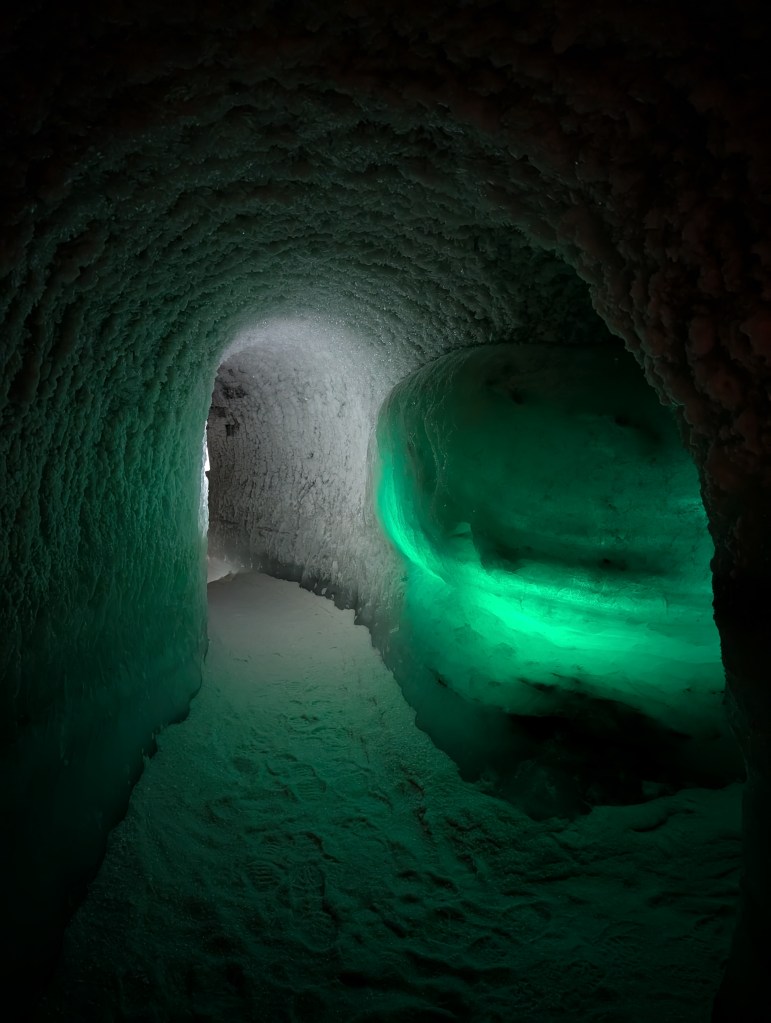
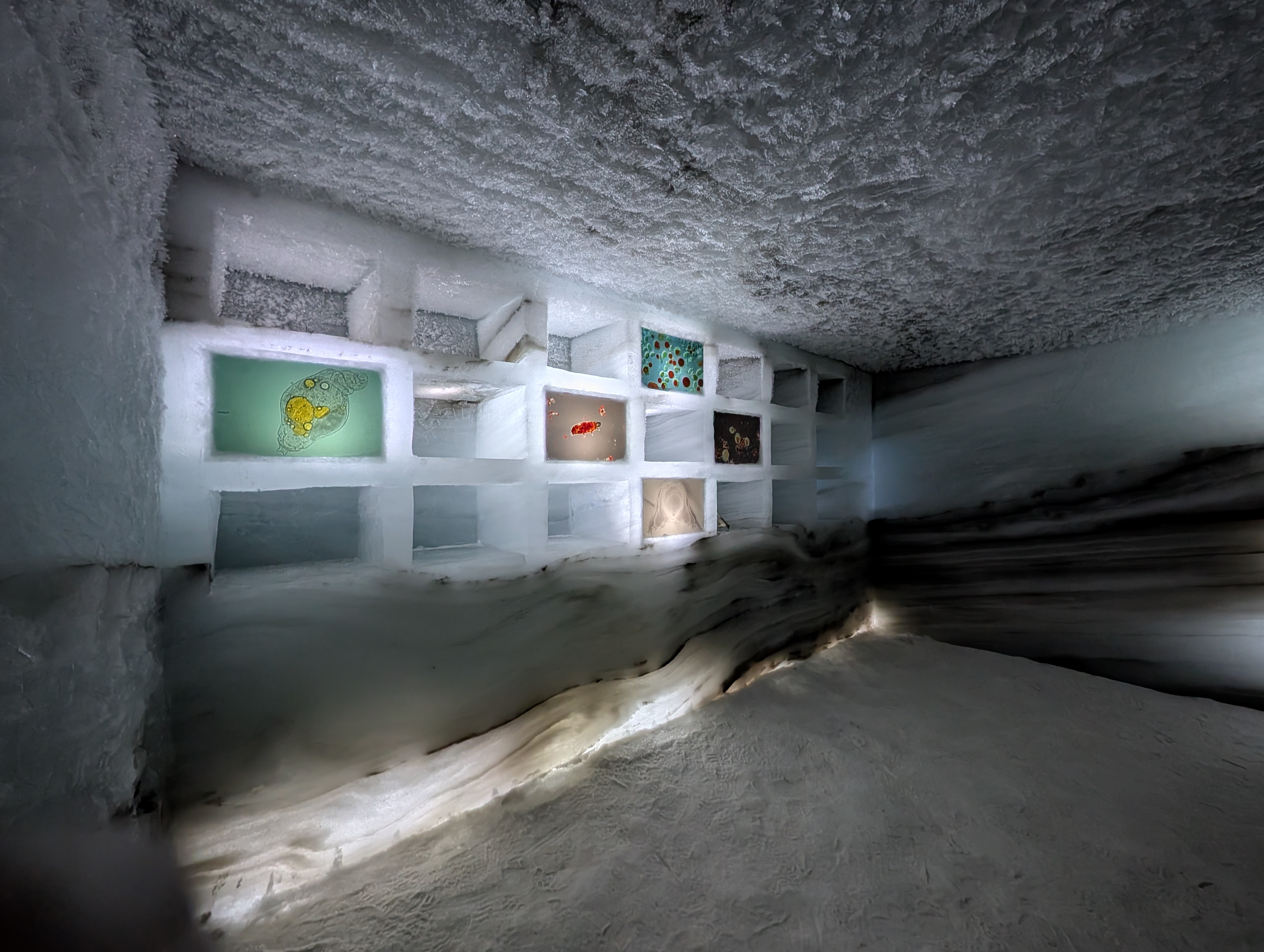
Hand-carved, ‘permanent’ ice cave.
The endpoint of the tour was inside a hand-carved, permanent ice cave. They showed a short informational film about the cave. Our guide(and other guides) said goodbye but stayed till each of us left the cave.
Following test carvings and radar measurements of the ice in 2009, the first ice tunnel was made in 2010. Sadly, due to heavy melting in 2011 it had to be closed, but a new tunnel was carved in spring 2012. The tunnel is dug entirely by hand, using purpose-made ice axes, and 800 cubic metres of ice have been shovelled onto and brought to the surface by pulk. With a ground area of some 375 square metres. The tunnel has solar and wind powered lighting.
The cave doesn’t melt in the summers, and is inaccessible in harsh winters but it owing to the climate changes, the cave is expected to melt in the next 5 years.

I recorded as much information as I could in two brief videos as follows:
I left the cave around 1215. I had decided that I would walk back at my own pace, and would reproduce the facts explained by the guide.
The cave is carved in Juvfonne.
Sherpastigen
Permafrost: Nature’s own freezer.
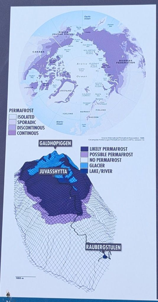
Permafrost is nature’s very own freezer. High up in the mountains and in cold regions, the ground temperature has stayed below freezing for thousands of years. Approximately 4 of the land area of the northern hemisphere has permafrost, and most of it is over 10 000 years old.
At Juvflye there is a permafrost, and only the top 1-2 metres of the ground will thaw every summer. Further down, there is frost that may stretch as far down as 300 metres. In 1999, a 129 metre-deep hole was drilled at Juvvasshøe (1894 metres above sea level) in order to measure the ground temperature.
Permafrost thawing is a global concern due to the direct emission of greenhouse gases to the atmosphere this will cause. The permafrost on the Asian and American continents contains enormous amounts of carbon, stored as frozen organic matter. When the permafrost thaws, carbon dioxide and methane are released into the atmosphere. Estimates show that carbon released from permafrost until year 2200 may be the equivalent of between 5% and 39 % of carbon emissions from all industrial activity. As we still do not have enough information on the extent of this problem, such emissions are rarely included in climate models.
100 metres down in the ground, the temperature is about -2.3°C all year round. The greatest thaw depth in permafrost recorded at Juvvasshøre is 2,44 meters, measured on September 11th 2018.
Measuring Instruments
This apparatus tries to simulate warmer conditions for the lichen that grows in the Jotunheimen area. In other words, the lichen growing inside that polygon is having the exact climatic conditions as the ones growing outside it except the inner temperatures are higher. Context: In the spring of 2024, the DNB Savings Bank Foundation gave 20 million to the Fjellviten project. The Norwegian Mountain Center and Climate Park 2469, together with several leading research institutions, will develop “the world’s most important classroom” with the high mountains as a knowledge arena. The main goal of the Mountain Knowledge project is to disseminate and transfer knowledge about climate and changing nature in the high mountains through digitalization of climate monitoring and new dissemination technology. The main target group is young people and young adults.
Lichen & Inc.
Lichen is abundant in Scandinavia, hence, never taken seriously by commoners like me. It was not until this guided tour that lichen drew my attention.
I have seen Lichen aplenty times, touched it, saw animals eat it but it was only yesterday I learned that it is a symbiosis of algae and fungus.
Map Lichen is one of parameters that help to deduce ice age of a particular region.
Glacier Buttercup(Beckwithia Glacialis)
Geology, and Glaciers.
Polygonal rocks/Permafrost patterns/Ice-wedge polygons.
The guide gave a cool demo about the formation of the polygonal rocks. I have tried to reproduce it in the following videos.
The soil here on Juvflye has permafrost, though, each summer the surface layer thaws. The water then trickles down into crevices between rocks and dirt. In the winter the water freezes and expands the cracks, since water increases in volume when it freezes. Over time the process repeats, and the ground slowly shifts and sorts the material into impressive shapes. The result is called polygonal soil. The most developed specimens have a hexagonal shape.
Gabbro – the iron rock !
This was the coolest finding, and demo during the entire guided tour !
Memorable drive from Juvasshytta !
I left from the Juvasshytta parking lot around 1330. I partially recorded the descending drive using my phone. The video does include my blabbering, so bear with me :D. It was a memorable drive because of the serpentine road, cliffs, and the enthralling mountains.
EOD
I reached the cottage around 1430. I wanted to visit the fjellsenter but I had digested enough information for the day, also I was hungry. I quickly prepared a light lunch, and gobbled it. My body and mind longed for a nap, and I fell asleep. I woke up around 1630, prepared some tea. While sipping it on the patio, I considered the following:
- Being a naive railfan, I wanted to visit the Norwegian Railway Museum as I would possibly never revisit this route in near future.
- I was too tired to drive back to Södertälje in a single day, like I did on the first day.
I then booked a hotel room in Charlottenberg. My plan was:
- Start whenever I can from Lom.
- Drive to the rail museum. Cover as much as I can.
- Drive from rail museum to Charlottenberg.
- Next day, drive from Charlottenberg to Södertälje.
I tidied my room a bit, and packed some stuff. I don’t recall when I fell asleep.
Day-5: Stay extension, and consecutive disappointments !
July 15, 2025(Tuesday)
I woke up around 0700. I had slowed down a bit. Getting ready, packing, and cleaning took me much longer. I checked out at 0950, and hit the road. I filled up at Otta, and I had skipped breakfast to have brunch here. I left Otta around 1115. The distance from here to the Norwegian Railway Museum was around 170km. I reached its parking around 1330.
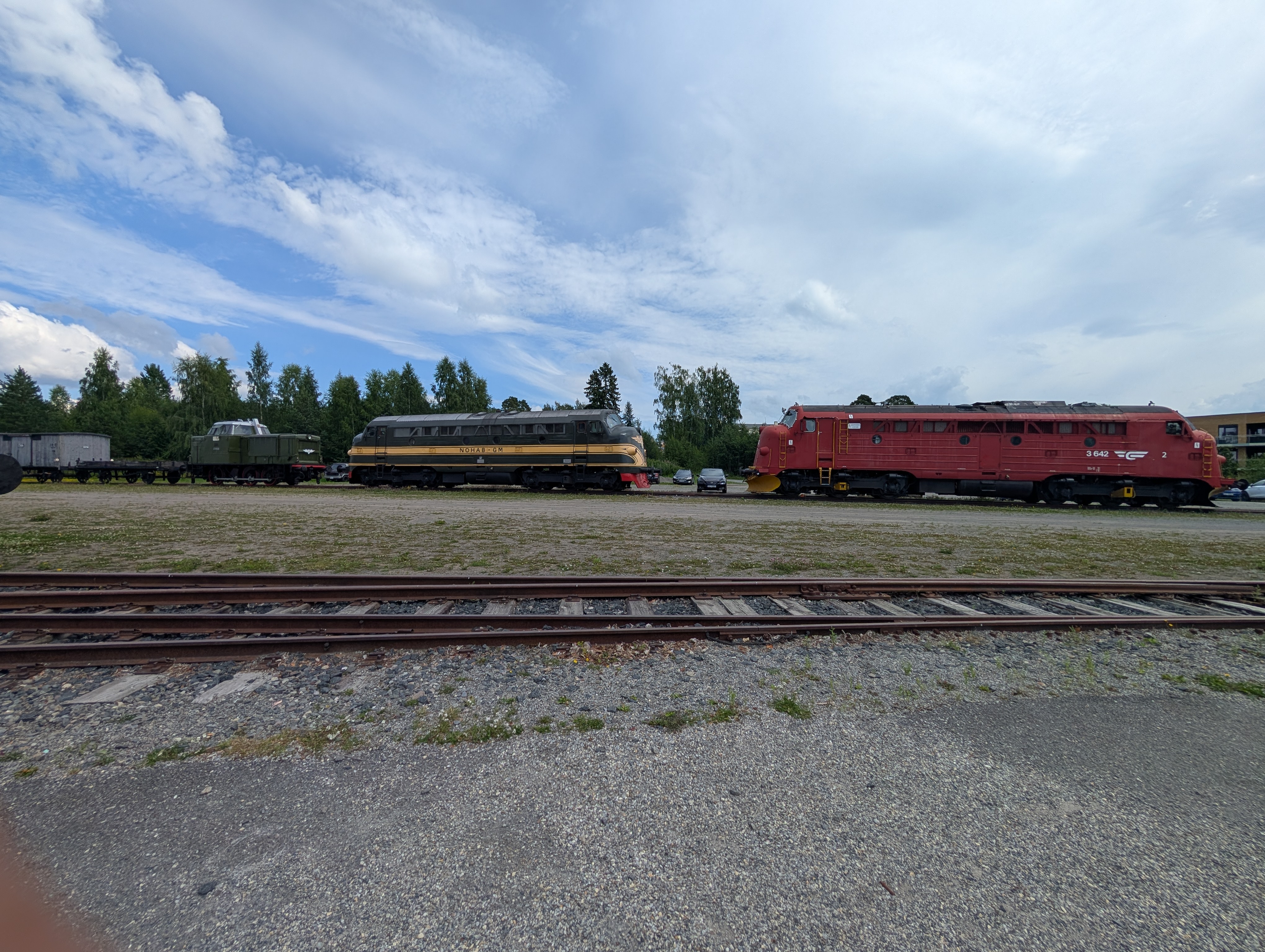
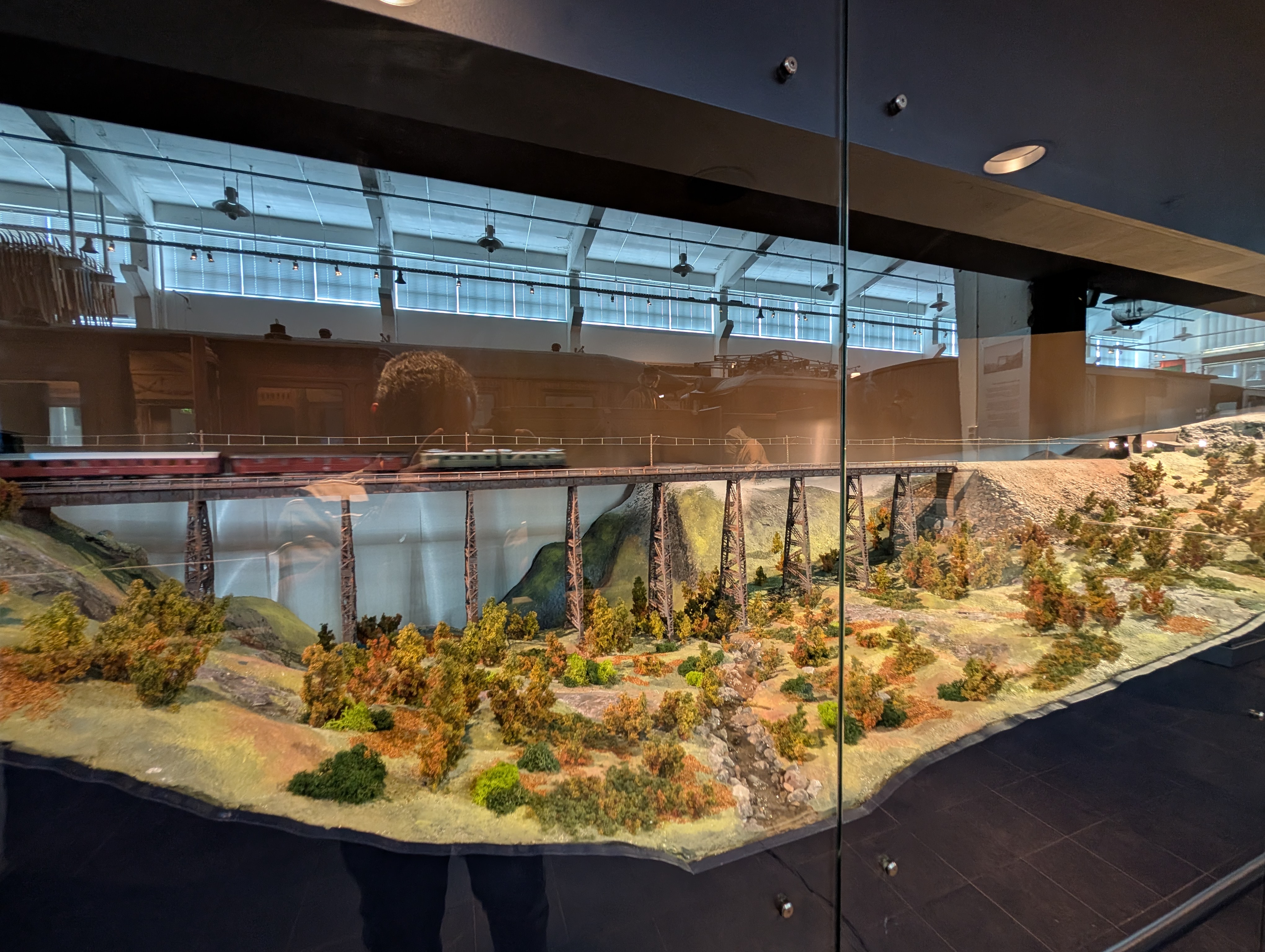
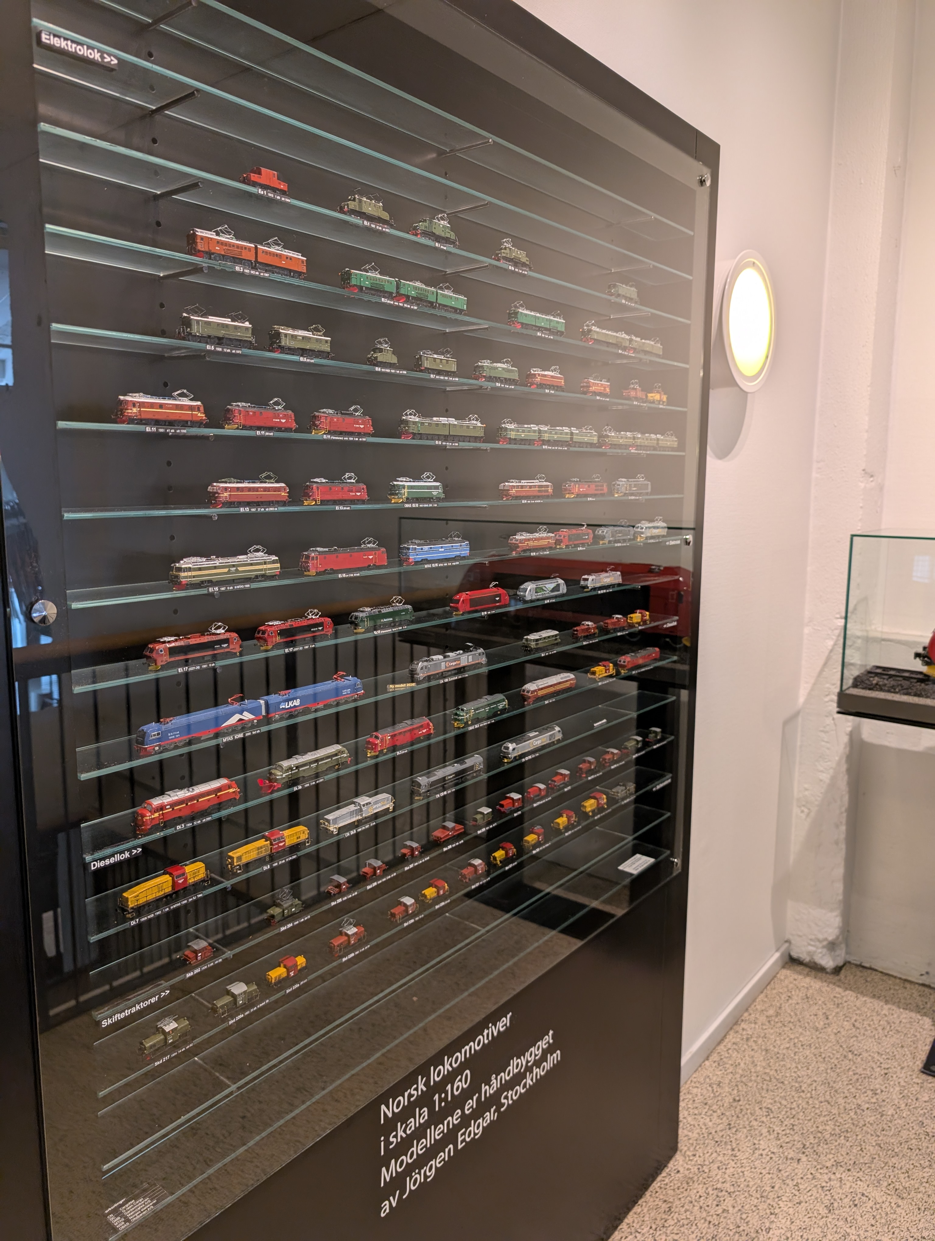
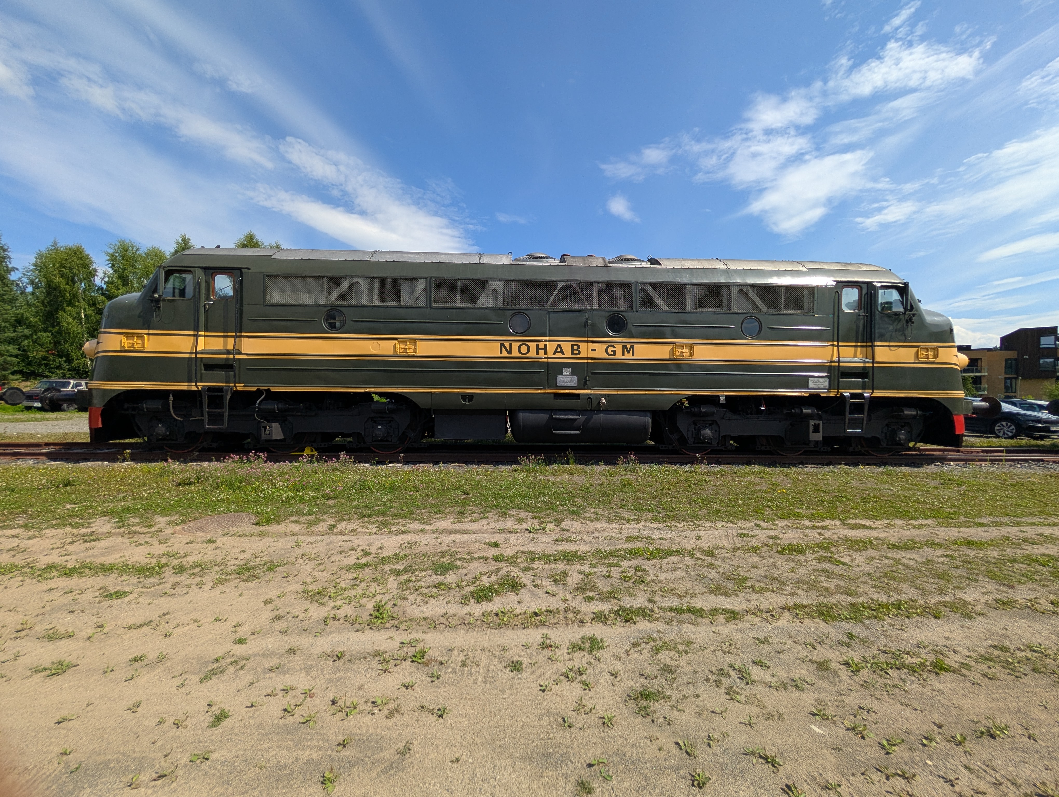
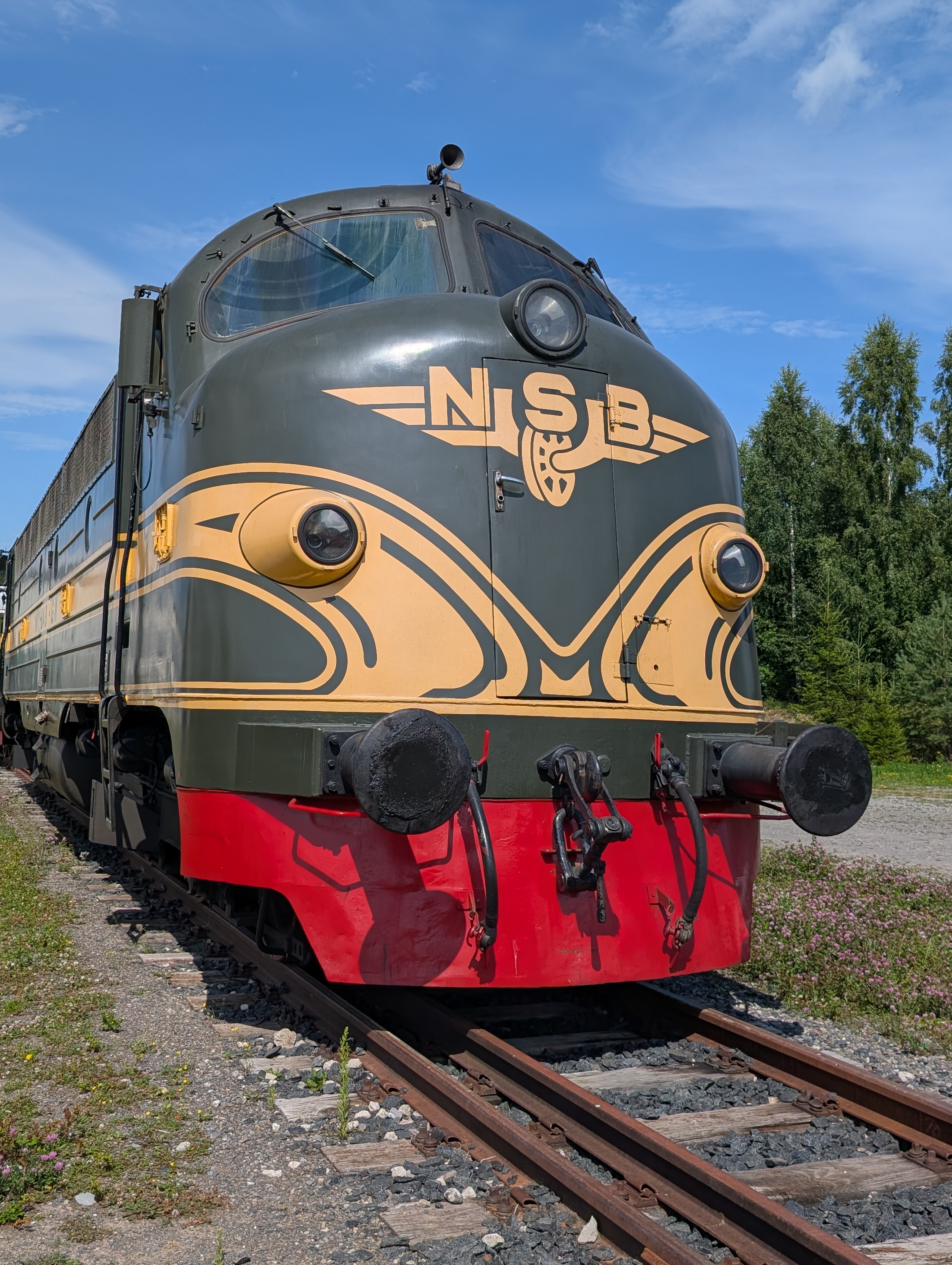
The museum might be a good experience with kids but as a railfan, I was pretty disappointed. The diesel-electric locomotives parked outside are a view but they haven’t bothered to put even a small information board for any of the locomotives. The scale models on the second floor, and for sale are the best part of the museum. It is a small museum with some railcars, and only one steam engine indoors, that too has been trimmed a bit. I took a detour just to visit this museum but it fell short.
I stayed at the museum for a little more than an hour. Charlottenberg was still around 150km from here. I reached the hotel around 1730. The room was too far to reach quickly, and worse part is that its air conditioner was allowing to set lower temperature. I was too tired to pack again, and ask for a change. I simply opened the window. I went for dinner at an Asian restaurant in the adjoining shopping mall. The food also turned out to be a disappointment, even kiosks serve better food.
I had enough for the day. I went back to the room, and went to bed around 2200. I couldn’t sleep well due to heat, and noises coming from nearby warehouses.
Day-6: Home Run
July 16, 2025(Wednesday)
I woke up around 0630. Bodily chores, shower, and packing were completed pretty fast. I then headed for the breakfast that was included. Filled myself, and hit the road around 0900.
My initial plan was to tour a bit in Karlstad but the past day had ruined my motivation. I took a lunch break near Eskilstuna, and reached Södertälje around 1530.
Epilogue
- Health is wealth. Prioritize good eating habits, and workout !!! Everything else can wait, or is expendable !!!
- Allocate more days for such trips e.g.: I could have invested two more days, and covered Norwegian fjellsenter, and perhaps an easy camping(I had carried my camping gear as well).
- I must thank the weather gods for allowing me to complete my hike !
- Keep a buffer day for absorbing the experiences, and relaxation.
- My confidence received a boost on two accounts:
- I managed yet another driving solo trip + hiking + cycling. This time, it was distance, time, and effort critical tour, and I didn’t screw up anywhere.
- My planning didn’t fail me anywhere, in fact I avoided several pitfalls.
- It is always refreshing to meet people from different countries. It enriches one’s bag of experiences.
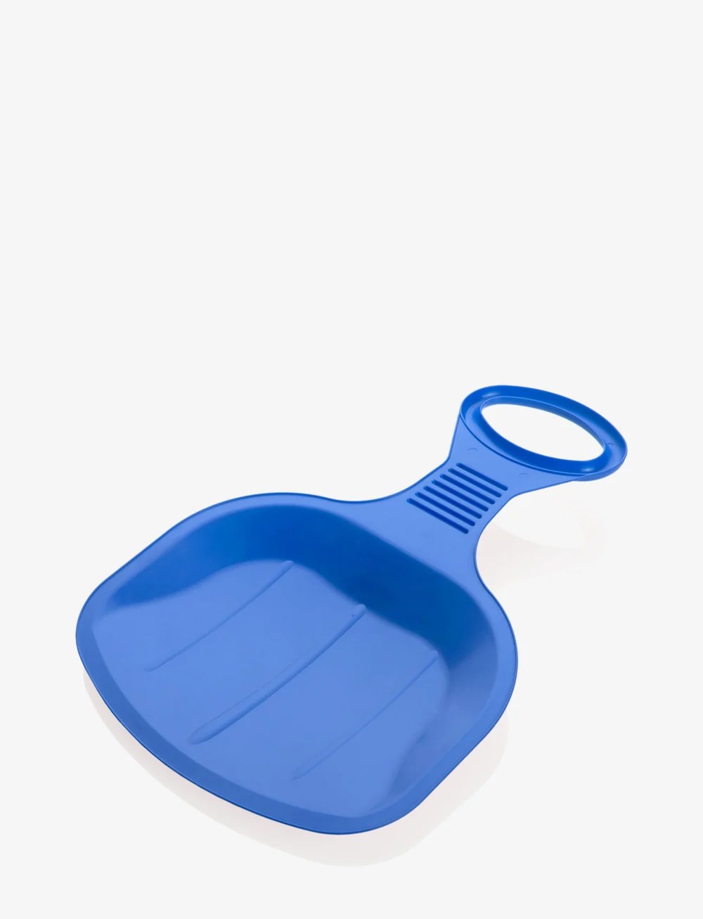
- Carry a bumboard like shown below for hikes where snow patches can be encountered: